Malls · Missouri
River Roads Mall
River Roads Mall opened 1962, lost anchors by 1995, closed, stood vacant until 2006 demolition; current status unknown. · summary, model-written
Solid = from the authors' map · outlined = public source · dashed = model-written, not yet reviewed by a person. Tap any value's source label to see where it came from. documented = a quoted excerpt (click to read it) · reported = a source named, no excerpt yet · no source.
Site profile8 elements · what this retrofit is built with · tap a chip for the evidence
Dillard's
This site: Dillard's wikipedia · all sites with thisCounty lost 10%+ of retail establishments since 2012
This site: -16% census-cbp · all sites with thisHigh earthquake risk
This site: Relatively High fema-nri · all sites with thisHigh heat wave risk
This site: Very High fema-nri · all sites with thisHigh natural hazard risk (FEMA NRI)
This site: Relatively High; heat wave, earthquake, hail, cold wave fema-nri · all sites with thisLower-income tract (< $50k)
This site: $32,065 census-acs · all sites with thisOpportunity Zone
This site: 29189212001 hud-oz · all sites with thisShrinking county
This site: -0.2% census-acs · all sites with thisNow
| Status | Status not verifiedWikidata reported |
|---|
Site context
| Transit within 800 m | no rail stationOpenStreetMap |
|---|---|
| FEMA flood zone | X · AREA OF MINIMAL FLOOD HAZARDFEMA NFHL |
| EPA-regulated facilities within 500 m | 15: ANDYS AUTO CARE INC; FIRESTONE STORES 21E6; JENNINGS CITY HALL; KFC; MCDONALD'SEPA FRS |
| Census tract 29189212004 | 3,743 people, 5,127 per sq mi; median household income $32,065; median gross rent $875; 43% renters; 5.9% vacant units; 18.7% commute by transitACS 2023 5-year |
| Within a 10–15 minute walk (800 m) | 4 of 6 daily needs: 0 grocers, 3 schools, 0 parks or playgrounds, 1 health, 3 civic, 1 food and drink; 4 cycleway segments, 69 sidewalk-tagged segmentsOpenStreetMap |
| Opportunity Zone | yes, tract 29189212001 (rural)HUD |
| Housing permits, St. Louis County (MO), 2024 | 504 units in 5+ unit buildings, 2 in 2–4, 687 single-family; 2023: 296 in 5+Census BPS |
| Social vulnerability (CDC SVI 2022, tract) | overall percentile 0.64; socioeconomic 0.80; housing and transport 0.21; 42% below 150% of poverty; 18% of households with no vehicleCDC/ATSDR |
| Other atlas sites nearby | 2 within 10 km, 14 within 25 km: Bellerive Country Club (6.0 km); Costa Verde Center (9.7 km)computed |
| Overture Maps | no place match; building footprint 2,764 m², 8.101958274841309 mOverture (CDLA-Permissive 2.0) |
| Attention: Wikipedia page views | 32,990 since 2015; 2,367 in the last 12 months (-26% vs the prior 12); peak 2023-12 with 583Wikimedia |
| Tract change 2013–2023 | tract boundary changed between the 2010 and 2020 census; no 2013 comparisonCensus ACS |
| Natural hazard risk (FEMA National Risk Index, tract) | relatively high overall (score 90.4); expected annual loss $2.4M; high: heat wave, earthquake, hail, cold wave; community resilience relatively highFEMA NRI |
| Tax-credit housing within 1 km | 4 LIHTC properties, 182 units: The Residences At Jennings Place Iii (54 units); The Residences At Jennings Place Ii, Lp (54 units); The Residences At Jennings Place (54 units)HUD LIHTC |
| Retail trade in the county, 2025 (BLS QCEW) | 56,251 jobs in 3,256 establishments; average annual pay $44,777; employment location quotient 0.97; employment -2.0% on the yearBLS QCEW 2025, NAICS 44-45, private |
| Jobs located in the tract, 2022 | 659 jobs; 92 in retail trade, 53 in accommodation and food (workplace blocks summed to tract 29189212004)Census LEHD LODES8 WAC 2022 |
| Upward mobility (Opportunity Atlas, 2010 tract) | children of low-income (25th percentile) families reached the 33th income percentile as adults; 4.9% incarcerated at the 2010 count (1,648 children in the sample); born 1978–83, measured 2014–15Opportunity Insights |
| Food access (USDA FARA 2019, 2010 tract) | not a low-access tract at 1 mile; 2% of residents more than 1 mile from a supermarket; poverty rate 22.1%; median family income $45,976; 908 SNAP householdsUSDA ERS |
| Schools | Jennings School District (PK-12); 6 public schools within 1 mile: ROSE JOHNSON JENNINGS JR. HIGH; NORTHVIEW ELEM.; JENNINGS HIGH; DANFORTH ELEM.NCES EDGE |
| Elevation | 513 ft above sea level at the site pointUSGS 3DEP |
| Storm events in the county, 2016-2025 | 342 county-logged events: 163 hail, 125 thunderstorm wind, 25 flash flood, 17 tornado; $61,208,500 property damage reported; 5 direct deaths; forecast-zone events (most flood, winter and heat) not countedNOAA Storm Events |
| Homes for sale in ZIP 63136, 2026-09 | median list price $84,900 (-5.1% on the year); 251 active listings; median 81 days on market; 34% with a price cutRealtor.com Research |
| Retail trade in the county, 2012 to 2023 | 3,211 establishments (-16%); 58,164 jobs (-13%)Census CBP |
| Housing market in the county | typical home value $285,675 (+3% 1 yr, +24% 5 yr); typical rent $1,490/mo (+4% 1 yr), 2026-09Zillow Research |
| House price index, tract, 2025 | 130 (2000 = 100), +61% 10 yrFHFA |
Summary, model-written
River Roads Mall opened in 1962 as an early enclosed shopping center with anchors J. C. Penney, F. W. Woolworth, Kroger, and Stix, Baer & Fuller. It was expanded in 1972, but began losing major stores in the early 1980s; J. C. Penney closed in 1983 (later reopened as an outlet) and Stix, Baer & Fuller became Dillard's before closing in 1986. Tenancy continued to decline through the 1990s, leading to the closure of the J. C. Penney outlet and the mall proper in 1995, although the abandoned structure was not demolished until 2006.
Why. The record shows that the mall’s decline was driven by the loss of anchor tenants and ongoing tenancy deterioration; no explicit mention of competition, debt, or demolition decisions is provided.
Where it stands. The mall’s current status is listed as unknown in the draft record, and no controlling owner or entity is identified in the provided data.
For a planner
- Early suburban mall model (opened 1962) with later expansion (1972) serves as a precedent for aging retail corridors.
- No specific policy tools or interventions are noted in the record.
- Open questions include future land use, ownership clarification, and any zoning or environmental considerations for the site.
For a developer
- Site size and current control are not specified in the record.
- Entitlement stage and any existing approvals are unknown.
- Context-layer constraints (flood risk, transit access, environmental factors) and market signals from tract data are not provided.
What we do not know yet
- Current ownership or controlling entity is unknown.
- Exact site dimensions and parcel boundaries are not given.
- Zoning designation and any entitlements or restrictions are unspecified.
- Environmental conditions, floodplain status, and transit proximity are not detailed.
- Whether the structure was fully demolished by 2006 or remnants remain is unclear from the record.
Generated by nvidia/nemotron-3-super-120b-a12b on NVIDIA API via Hermes CT from the fields, parcels, deals and context layers on this page, with no outside knowledge. It is regenerated when the record changes and has not been checked by a person. How it is made.
Elsewhere on the web
Retail history: River Roads Mall on DeadMalls.com photos, field notes and visitor memories since 2000; matched by name and city; nothing copied here
Pages with photos
- River Roads Mall, Jennings, MO - 2380 Grand River Rd, New Halls F… whereorg.com
- River Roads Mall, corner of Halls Ferry Road and Jennings Station Road, Jennings, Missouri commons.wikimedia.org
- River Roads Mall (1962-2006) - Clio theclio.com
- RIVER ROADS MALL (Jennings) - Qué SABER a… tripadvisor.es
- River Roads Mall (Jennings) - Lohnt es sich? Aktuell für 202… tripadvisor.ch
- Exterior of Stix, Baer, and Fuller at River Roads Mall, corner of Halls Ferry Road and Jennings Station Road, Jennings, collections.mohistory.org
- River Roads Mall - low-rise building in Jennings, United States (1961 ... skydb.net

Search images: Google · Bing · Commons · references: ULI case studies · Google Scholar
History and original facts
| Anchors | F. W. Woolworth Company, Dillard's |
|---|---|
| County | St. Louis County |
| Census division | 4 · West North Central |
| Notes | Wikipedia categories: Demolished shopping malls in the United States |
Not yet recorded: acres, GLA, year opened, original developer, what is there now, retrofit year. Know it? Tell us.
Background
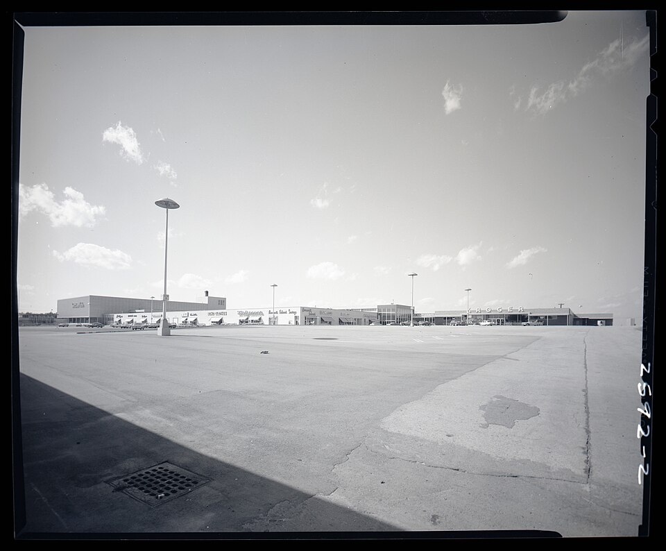
River Roads Mall, also known as River Roads Shopping Center, was an enclosed shopping mall located in the city of Jennings, a suburb of St. Louis, Missouri, United States. Opened in 1962 as one of the nation's first shopping malls, it featured J. C. Penney, F. W. Woolworth Company, Kroger, and Stix, Baer & Fuller as its anchor stores. The mall was expanded in 1972 with a new location of J. C. Penney, but began losing major stores in the early 1980s. J. C. Penney closed in 1983, but was soon reopened as an outlet store, while Stix, Baer & Fuller was sold to Dillard's in 1984 and closed only two years later. Tenancy continued to decline throughout the 1990s, culminating in the closure of the J. C. Penney outlet and mall proper in 1995, although the abandoned structure was not demolished until 2006.
Excerpt from Wikipedia (authors and history), CC BY-SA 4.0. May be older than the record above.
Sources
- Wikipedia: River Roads Mall · 2026-10-03 · CC BY-SA 4.0
More in Missouri
 Bannister MallKansas City, MO · 2014Redeveloped · Redevelopment: officeNorthwest Plaza MallSt Anns, MO · 2013Partial Redeveloped · Reinhabited · Partial redevelopment: demolition and new retail Partial…Red Roof MallBranson, MO · 2014Partial Regreened · Partial regreening, baseball fieldArmorySt. Louis, MOReinhabitation, proposed · high end office spaceBellerive Country ClubBellerive Acres, MORedeveloped · University of Missouri–St. Louis