Other · Georgia
Peachtree Arcade
Peachtree Arcade opened 1918, demolished 1964 for First National Bank Building; owned by GA Board of Regents on 0.38‑acre site. · summary, model-written
Solid = from the authors' map · outlined = public source · dashed = model-written, not yet reviewed by a person. Tap any value's source label to see where it came from. documented = a quoted excerpt (click to read it) · reported = a source named, no excerpt yet · no source.
Site profile14 elements · what this retrofit is built with · tap a chip for the evidence
Closed or demolished, no retrofit recorded
This site: …demolished extraction · all sites with thisUniversity, hospital or church
This site: BOARD OF REGENTS OF THE UNIVERSITY SYSTEM OF GA county-parcels · all sites with this15-minute neighbourhood (5+ of 6 daily needs within 800 m)
This site: 6/6 openstreetmap · all sites with this200+ tax-credit housing units within 1 km
This site: 971 units in 8 properties hud-lihtc · all sites with this3+ other atlas sites within 10 km
This site: 29 within 10 km computed · all sites with thisBike network nearby
This site: 125 ways openstreetmap · all sites with thisCounty permitting 2,000+ apartment units a year
This site: 8,159 units, Fulton County census-bps · all sites with thisGrocery within 800 m
This site: 5 stores openstreetmap · all sites with thisHigh earthquake risk
This site: Relatively High fema-nri · all sites with thisHigh inland flooding risk
This site: Relatively High fema-nri · all sites with thisHigh natural hazard risk (FEMA NRI)
This site: Relatively High; tornado, inland flooding, earthquake, hail fema-nri · all sites with thisHigh tornado risk
This site: Relatively High fema-nri · all sites with thisNational Register place within 500 m
This site: Western and Atlantic Railroad Zero Milepost; Fulton County Courthouse nps-nrhp · all sites with thisRenter-majority tract
This site: 71% census-acs · all sites with thisNow
| Status | Demolishedextracted, unreviewed |
|---|---|
| What is there now | First National Bank Building (skyscraper)extracted, unreviewed documentedThe First National Bank Building that replaced it was completed in 1966 and was the tallest building in both Atlanta and the entire southeastern United States at the time. |
| Owner of record | Board Of Regents Of The University System Of Gacounty assessor reported |
Parcels, tax and title
| Parcel | Owner of record | Acres | Use · zoning | Value (appraised · assessed · taxable) | Last sale · deed | ||||||||||||||||||||||||||||||||||||||||||
|---|---|---|---|---|---|---|---|---|---|---|---|---|---|---|---|---|---|---|---|---|---|---|---|---|---|---|---|---|---|---|---|---|---|---|---|---|---|---|---|---|---|---|---|---|---|---|---|
14 007800130581all 26 county fields
| Board Of Regents Of The University System Of Ga 244 WASHINGTON ST SW, ATLANTA GA 30334 | 0.4 | 613 | $26.9M (appraised) assessed $0 | — | ||||||||||||||||||||||||||||||||||||||||||
| Total | 0.4 | $26.9M |
Site context
| FEMA flood zone | X · AREA OF MINIMAL FLOOD HAZARDFEMA NFHL |
|---|---|
| EPA-regulated facilities within 500 m | 403: 175 TED TURNER DRIVE, S.W, ATLANTA; 222 MITCHELL STREET; 2A URBAN IMPROVEMENTS; 4538 CALEB; A PROPOSED ACCESS ROAD FOR GEORGIA INTERNATIONAL INDUSTRIAL EPA FRS |
| Census tract 13121011901 | 1,857 people, 4,097 per sq mi; median household income $55,000; median gross rent $1,118; 71% renters; 9.7% vacant units; 8.3% commute by transitACS 2023 5-year |
| Within a 10–15 minute walk (800 m) | 6 of 6 daily needs: 5 grocers, 5 schools, 68 parks or playgrounds, 8 health, 15 civic, 100 food and drink; 125 cycleway segments, 733 sidewalk-tagged segmentsOpenStreetMap |
| Opportunity Zone | noHUD |
| National Register places within 500 m | 14: Western and Atlantic Railroad Zero Milepost; Fulton County Courthouse; Healey Building; Rhodes-Haverty BuildingNPS |
| Housing permits, Fulton County (GA), 2024 | 8,159 units in 5+ unit buildings, 481 in 2–4, 2,937 single-family; 2023: 7,096 in 5+Census BPS |
| Social vulnerability (CDC SVI 2022, tract) | overall percentile 0.69; socioeconomic 0.82; housing and transport 0.94; 48% below 150% of poverty; 42% of households with no vehicleCDC/ATSDR |
| Other atlas sites nearby | 29 within 10 km, 52 within 25 km: Boisfeuillet Jones Atlanta Civic Center site (0.1 km); 2 Peachtree Street (0.1 km); Carver Community (0.1 km); Altmore (0.1 km); One Park Tower (0.1 km)computed |
| Overture Maps | no place match; building footprint 1,968 m², 169.0 mOverture (CDLA-Permissive 2.0) |
| Attention: Wikipedia page views | 21,313 since 2015; 2,383 in the last 12 months (-14% vs the prior 12); peak 2022-09 with 3,435Wikimedia |
| Tract change 2013–2023 | tract boundary changed between the 2010 and 2020 census; no 2013 comparisonCensus ACS |
| Natural hazard risk (FEMA National Risk Index, tract) | relatively high overall (score 88.9); expected annual loss $2.6M; high: tornado, inland flooding, earthquake, hail; community resilience relatively highFEMA NRI |
| Tax-credit housing within 1 km | 8 LIHTC properties, 971 units: Capitol Gateway Phase I (269 units); Welcome House, Sro (209 units); City Plaza Apartments (164 units)HUD LIHTC |
| Retail trade in the county, 2025 (BLS QCEW) | 55,938 jobs in 4,327 establishments; average annual pay $50,638; employment location quotient 0.60; employment -2.8% on the yearBLS QCEW 2025, NAICS 44-45, private |
| Jobs located in the tract, 2022 | 26,902 jobs; 116 in retail trade, 3,359 in accommodation and food (workplace blocks summed to tract 13121011901)Census LEHD LODES8 WAC 2022 |
| Upward mobility (Opportunity Atlas, 2010 tract) | children of low-income (25th percentile) families reached the 29th income percentile as adults; 3.4% incarcerated at the 2010 count (690 children in the sample); born 1978–83, measured 2014–15Opportunity Insights |
| Food access (USDA FARA 2019, 2010 tract) | low-income, low-access tract (1 mile urban / 10 miles rural); 55% of residents more than 1 mile from a supermarket; poverty rate 35.3%; median family income $31,827; 409 SNAP householdsUSDA ERS |
| Schools | Atlanta City School District (PK-12); 2 public schools within 1 mile: Department of Human Resources; Wesley International Academy CharterNCES EDGE |
| Elevation | 1,038 ft above sea level at the site pointUSGS 3DEP |
| Storm events in the county, 2016-2025 | 266 county-logged events: 174 thunderstorm wind, 48 flash flood, 34 hail, 10 tornado; $9,525,000 property damage reported; 2 direct deaths; forecast-zone events (most flood, winter and heat) not countedNOAA Storm Events |
| Homes for sale in ZIP 30303, 2026-09 | median list price $223,675 (+12.4% on the year); 39 active listings; median 119 days on market; 27% with a price cutRealtor.com Research |
| Retail trade in the county, 2012 to 2023 | 3,732 establishments (+10%); 55,757 jobs (+14%)Census CBP |
| Housing market in the county | typical home value $414,221 (-2% 1 yr, +11% 5 yr); typical rent $1,926/mo (+3% 1 yr), 2026-09Zillow Research |
| Traffic on the busiest road within 600 m (2024) | 9,870 vehicles a day on Central Ave SW; (minor arterial, 4 lanes); 40 counted segmentsFHWA HPMS |
Summary, model-written
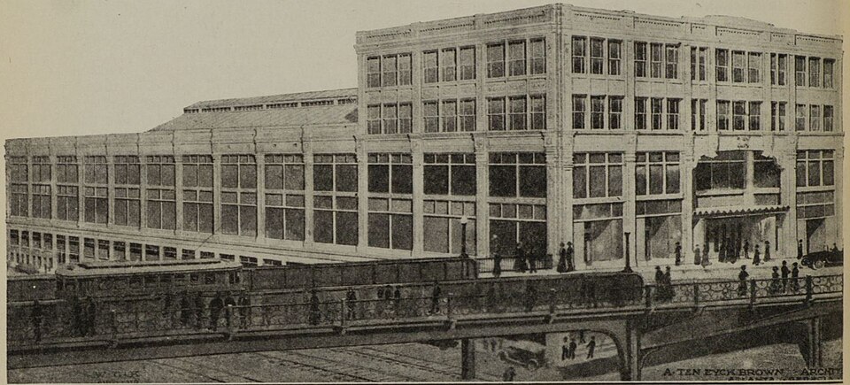
The Peachtree Arcade opened in 1918 as a downtown shopping arcade modeled after Cleveland’s Arcade, designed by A. Ten Eyck Brown and peaking at about 40 stores. It served as a popular civic hub until the 1960s, when rising competition from suburban malls led to its demolition in 1964 to make way for the First National Bank Building skyscraper, completed in 1966.
Why. The demolition was driven by increased competition from suburban shopping centers that drew customers away from downtown Atlanta.
Where it stands. Today the site is occupied by the First National Bank Building and is owned by the Board of Regents of the University System of Georgia.
For a planner
- Precedent: early 20th‑century arcade replaced by mid‑century office tower, reflecting urban renewal patterns.
- Policy tools: no explicit incentives or preservation measures noted in the record; demolition appears market‑driven.
- Open questions: how the current skyscraper fits with downtown zoning, historic preservation interests, and potential adaptive reuse.
For a developer
- Site size: 0.3812 acres (single parcel).
- Control: owned by the Board of Regents of the University System of Georgia; no private owner listed.
- Entitlement stage: the First National Bank Building is already constructed, implying full build‑out entitlements.
- Context constraints: record does not specify flood, transit, or environmental limitations.
- Market signals: Atlanta‑Fulton County grew 4.6% 2018‑23; median rent $1,635; opportunity score 25 suggests modest redevelopment interest.
What we do not know yet
- Exact current use and condition of the First National Bank Building beyond its completion date are not detailed.
- No information on floodplain, seismic, or environmental constraints for the parcel.
- Transit access and proximity to infrastructure are not described in the record.
- The owner’s development intentions or any lease arrangements are unspecified.
- Data verification status is ‘draft,’ indicating some facts may be unreviewed.
Generated by nvidia/nemotron-3-super-120b-a12b on NVIDIA API via Hermes CT from the fields, parcels, deals and context layers on this page, with no outside knowledge. It is regenerated when the record changes and has not been checked by a person. How it is made.
Elsewhere on the web
Pages with photos
- Peachtree Arcade Atlanta, GA Postcard cardcow.com
- The Midtown Atlanta Archive | The Peachtree Arcade was d… themidtownarchive.tumblr.com
- THE PEACHTREE ARCADE - YouTube youtube.com
- Peachtree Arcade - New Georgia Encycl… georgiaencyclopedia.org
- Peachtree Arcade - Digital Library of Ge… dlg.usg.edu
Search images: Google · Bing · Commons · references: ULI case studies · Google Scholar
Multifamily screen
- closed or demolished site (sourced)
- already in play: under construction, approved, or sold to a developer with housing plans
- county grew 4.6% 2018–23
- median rent $1,635
Inputs: record fields (size, status) and county Census ACS 2018–2023 figures (growth, rent). How the points work. Not a recommendation.
History and original facts
| Opened | 1918extracted, unreviewed |
|---|---|
| Closed | 1964extracted, unreviewed |
| Stores at peak | 40extracted, unreviewed reported |
| Original developer | R. R. Otisextracted, unreviewed documentedThe idea for a shopping arcade in Atlanta was proposed by local businessman R. R. Otis, a partner in the real estate firm of Otis & Holliday. |
| Architect | A. Ten Eyck Brown |
| County | Fulton County |
| Census division | 5 · South Atlantic |
| Notes | Wikipedia categories: Demolished shopping malls in the United States |
Not yet recorded: acres, GLA, retrofit year. Know it? Tell us.
Background
The Peachtree Arcade was a shopping arcade in downtown Atlanta, Georgia, United States. The building, modeled after the Arcade in Cleveland, was designed by Atlanta-based architect A. Ten Eyck Brown and was located between Peachtree Street and Broad Street near Five Points. Construction began in 1917 and was completed the following year. Located in the city's central business district, it was very popular with citizens, functioning as an unofficial "civic center" for the city. However, by the 1960s, the arcade was facing increased competition from shopping malls located in Atlanta's suburbs, and in 1964, the building was demolished to make way for the First National Bank Building, a skyscraper that, at the time of its construction, was the tallest building in both Atlanta and the southeastern United States. In 1993, the American Institute of Architects named the building as one of Atlanta's most notable landmarks to have been destroyed.
Excerpt from Wikipedia (authors and history), CC BY-SA 4.0. May be older than the record above.
Timeline
- 1916 Architect A. Ten Eyck Brown designs the arcade
- 1917 Construction begins
- 1918 Construction completed
- 1964 Arcade demolished
- 1966 First National Bank Building completed
- 1993 AIA lists arcade among demolished landmarks
Sources
- Wikipedia: Peachtree Arcade · supports: after notes, original developer, status, year closed, year opened
11 quoted sentences
it wasn't completely finished until 1918.
The arcade was demolished in 1964.
The idea for a shopping arcade in Atlanta was proposed by local businessman R. R. Otis, a partner in the real estate firm of Otis & Holliday.
The First National Bank Building that replaced it was completed in 1966 and was the tallest building in both Atlanta and the entire southeastern United States at the time.
More in Georgia
 Phipps PlazaAtlanta, GA · 2018Partial Redeveloped · Partial redevelopment, mixed use