Malls · Alabama
McFarland Mall
McFarland Mall opened 1969, lost anchors, phased demolition 2014‑2025, now fully demolished; owner Stan Pate eyes mixed‑use redevelopment in Tuscaloosa · summary, model-written
Solid = from the authors' map · outlined = public source · dashed = model-written, not yet reviewed by a person. Tap any value's source label to see where it came from.
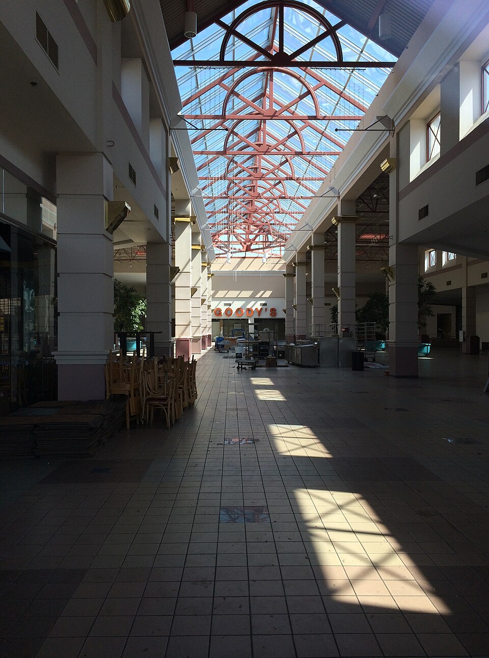
Site profile17 elements · what this retrofit is built with · tap a chip for the evidence
Dillard's
This site: Dillard's wikipedia · all sites with thisWoolco
This site: Woolco wikipedia · all sites with thisZayre
This site: Zayre wikipedia · all sites with thisOn Facebook
This site: …https://www.facebook.com/120449171334326 overture · all sites with thisWebsite alive
This site: …http://www.mcfarlandmall.com overture / http check · all sites with this15-minute neighbourhood (5+ of 6 daily needs within 800 m)
This site: 6/6 openstreetmap · all sites with this30,000+ vehicles a day on an adjacent road
This site: 65,697 on Skyland Blvd E fhwa-hpms · all sites with thisBike network nearby
This site: 15 ways openstreetmap · all sites with thisFast-growing county (8%+ 2018–23)
This site: 13% census-acs · all sites with thisGrocery within 800 m
This site: 4 stores openstreetmap · all sites with thisInterstate or freeway within 600 m
This site: Skyland Blvd E fhwa-hpms · all sites with thisOpportunity Zone
This site: 01125012303 hud-oz · all sites with thisRenter-majority tract
This site: 50% census-acs · all sites with thisRedeveloped
This site: extraction · all sites with thisHotel
This site: …new_use field extraction · all sites with thisMixed use
This site: …new_use field extraction · all sites with thisRetail (continued)
This site: …new_use field extraction · all sites with thisNow
| Status | Demolishedextracted, unreviewed |
|---|---|
| Strategy | Redevelopedextracted, unreviewed |
| New uses | retail, hotel, mixedextracted, unreviewed |
| Redeveloper | Stan Pateextracted, unreviewed |
Site context
| Transit within 800 m | no rail stationOpenStreetMap |
|---|---|
| Motorway junctions within 2 km | 73OpenStreetMap |
| FEMA flood zone | no NFHL polygon at point (unmapped or outside coverage)FEMA NFHL |
| EPA-regulated facilities within 500 m | 14: ADOT IM 0591 207; CHEDDAR'S CASUAL CAFE; ENCORE TUSCALOOSA, LLC; HARPER CHAMBERS; IM-NH-I059(399) PS 1839EPA FRS |
| Census tract 01125012307 | 1,651 people, 1,738 per sq mi; median household income $51,142; median gross rent $1,115; 50% renters; 16.7% vacant units; 0.0% commute by transitACS 2023 5-year |
| Within a 10–15 minute walk (800 m) | 6 of 6 daily needs: 4 grocers, 5 schools, 5 parks or playgrounds, 4 health, 1 civic, 24 food and drink; 15 cycleway segments, 0 sidewalk-tagged segmentsOpenStreetMap |
| Opportunity Zone | yes, tract 01125012303 (rural)HUD |
| Housing permits, Tuscaloosa County (AL), 2024 | 69 units in 5+ unit buildings, 52 in 2–4, 510 single-family; 2023: 61 in 5+Census BPS |
| Social vulnerability (CDC SVI 2022, tract) | overall percentile 0.28; socioeconomic 0.57; housing and transport 0.06; 42% below 150% of poverty; 0% of households with no vehicleCDC/ATSDR |
| Overture Maps | place McFarland Mall (shopping_mall, confidence 0.92, from Foursquare, Overture, Overture-signals); building footprint 4,982 m², 4.552338123321533 mOverture (CDLA-Permissive 2.0) |
| Website and social | www.mcfarlandmall.com (alive) · social: facebookOverture / Internet Archive |
| Attention: Wikipedia page views | 36,620 since 2015; 2,753 in the last 12 months (-4% vs the prior 12); peak 2022-04 with 894Wikimedia |
| Tract change 2013–2023 | tract boundary changed between the 2010 and 2020 census; no 2013 comparisonCensus ACS |
| Natural hazard risk (FEMA National Risk Index, tract) | very low overall (score 10.9); expected annual loss $483,830; community resilience relatively highFEMA NRI |
| Tax-credit housing within 1 km | 1 LIHTC properties, 152 units: Forrester Gardens (152 units)HUD LIHTC |
| Retail trade in the county, 2012 to 2023 | 696 establishments (-5%); 10,074 jobs (+2%)Census CBP |
| Housing market in the county | typical home value $249,799 (+1% 1 yr, +16% 5 yr); typical rent $1,679/mo (+4% 1 yr), 2026-09Zillow Research |
| Traffic on the busiest road within 600 m (2024) | 65,697 vehicles a day on Skyland Blvd E (Interstate, 6 lanes); 20,366 trucks; 37 counted segmentsFHWA HPMS |
Summary, model-written
Opened in 1969 as a 497,000‑square‑foot L‑shaped mall with 40 stores, anchored by Gayfers and later Dillard's. Over time anchors left (Woolco/Zayre, T.J. Maxx) and demolition began on Dillard's in 2014, continued on the former Chili's in 2020, finishing with Dollar Tree's closure and building demolition in 2025. The site is now fully demolished.
Why. Anchor tenant losses and the subsequent phased demolition led to the mall's closure; competition and debt are not stated in the record.
Where it stands. The mall is currently demolished and under the control of Stan Pate, who owned it from 2009 to present.
For a planner
- Redevelopment strategy noted with planned new uses of retail, hotel, and mixed‑use.
- No explicit policy tools or zoning changes recorded; entitlement status unclear.
- Open questions include required environmental review, floodplain status, transit access, and community approval processes.
For a developer
- Site size: 497,000 sq ft L‑shaped parcel.
- Controlled by owner Stan Pate (since 2009); no co‑owners listed.
- Entitlement stage: strategy lists redevelop; specific permits or approvals not detailed in record.
- No recorded flood, transit, or environmental constraints in the context layers.
- Market signals: opp_score 55, opp_reasons cite county growth 13.5% (2018‑23) and housing presence, indicating moderate opportunity.
What we do not know yet
- Exact reasons for anchor loss (competition, debt, management) not stated in record.
- Current zoning, land‑use entitlements, and any pending permits are unknown.
- Environmental constraints (floodplain, wetlands, contamination) are not recorded.
- Transit access and infrastructure capacity are not described.
- Data verification status is draft; some fields are model‑extracted and unreviewed.
Generated by nvidia/nemotron-3-super-120b-a12b on NVIDIA API via Hermes CT from the fields, parcels, deals and context layers on this page, with no outside knowledge. It is regenerated when the record changes and has not been checked by a person. How it is made.
Similar sites
- Cache Valley Mall, Logan, UT · Malls · opened 1976; closed 2024; same strategy: redevelop
- Chesterfield Mall, Chesterfield, MO · Malls · opened 1976; closed 2024; same strategy: redevelop
- DeSoto Square Mall, South Bradenton, FL · Malls · opened 1973; closed 2021; same strategy: redevelop
- Eastfield Mall, Springfield, MA · Malls · opened 1967; closed 2023; same strategy: redevelop
Elsewhere on the web
Retail history: McFarland Mall on DeadMalls.com photos, field notes and visitor memories since 2000; matched by name and city; nothing copied here
Pages with photos
- PHOTOS: Take A Look Back At McFarland Mall tuscaloosanews.com
- McFarland Mall Tuscaloosa, AL (15433273382) commons.wikimedia.org
- McFarland Mall Tuscaloosa, AL March 2014 | Flickr flickr.com
- PHOTOS REVEAL THE FATE OF ABANDONED MCFARLAND MALL IN TUSCALOOSA, ALABAMA y105music.com
- Inside McFarland Mall In Tuscaloosa, AL: Boom Years, L… bestattractions.org
- Sky City: Retail History: McFarland Mall: Tuscaloo… skycity2.blogspot.com

Search images: Google · Bing · Commons · references: ULI case studies · Google Scholar
Multifamily screen
- closed or demolished site (sourced)
- county grew 13.5% 2018–23
- housing in the record
Inputs: record fields (size, status) and county Census ACS 2018–2023 figures (growth, rent). How the points work. Not a recommendation.
History and original facts
| Opened | 1969Wikidata |
|---|---|
| Closed | 2025extracted, unreviewed |
| Stores at peak | 40extracted, unreviewed |
| Original developer | Ward Wharton McFarland and James Hintonextracted, unreviewed |
| Architect | Brandon Crawford and Associates of Birmingham |
| Anchors | Woolco, Zayre, T.J. Maxx, Dillard's, Goody's Family Clothing, Gayfers, Winn-Dixie |
| County | Tuscaloosa County |
| Census division | 6 · East South Central |
| Notes | Wikipedia categories: Demolished shopping malls in the United States |
Not yet recorded: acres, GLA, what is there now, retrofit year. Know it? Tell us.
Background
McFarland Mall was a regional 497,000-square-foot (46,200 m2) L-shaped shopping mall on Skyland Boulevard in Tuscaloosa, Alabama. Located near the interchange of Interstate 20/59 with McFarland Boulevard, it was in the southern section of the city. Opening on February 19, 1969, the mall replaced Woods Square Shopping Center and Leland Shopping Center as the main commercial retail center in the Tuscaloosa area. Brandon Crawford and Associates of Birmingham was the architect for the mall. General contractor for the project was N.C. Morgan Construction Company of Tuscaloosa. McGiffert and Associates of Tuscaloosa provided the engineering services for the mall.
Excerpt from Wikipedia (authors and history), CC BY-SA 4.0. May be older than the record above.
Timeline
- 1969 Opened (Wikidata)
- 1969 Mall opened
- 1975 Gayfers added second floor
- 1980 Renovations added food court and Goody's anchor
- 1983 Woolco closed, replaced by Zayre
- 1998 Gayfers acquired by Dillard's
- 2009 Stan Pate purchased mall
- 2014 Demolition commenced on Dillard's anchor store
- 2016 T.J. Maxx left the mall
- 2020 Demolition restarted on former Chili's
- 2025 Dollar Tree closed and building demolished
Sources
- Wikipedia: McFarland Mall · supports: original developer, status, strategy, year closed
14 quoted sentences
Dollar Tree, the last operating business in McFarland Mall, closed in July 2025, with the building being demolished the following month.
The center was originally developed at an estimated $4.5 million by Ward Wharton McFarland and James Hinton.
with the building being demolished the following month.
In December 2012, Stan Pate announced development plans to start sometime in 2013. Under these plans, most of the mall would have been demolished, including the former Dillard's building.
More in Alabama
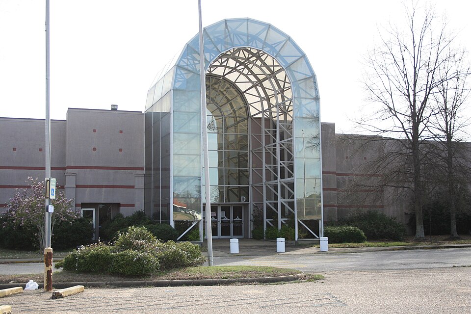 Montgomery MallMontgomery, AL · 2012Partial Regreened · Reinhabited · Partial reinhabitation: education, 2017 Partial regreening: sports,…Brookwood VillageHomewood, ALStatus not verified
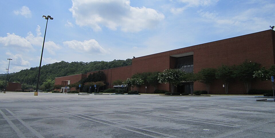 Century PlazaBirmingham, AL · 2020Redeveloped · Amazon logistics facility
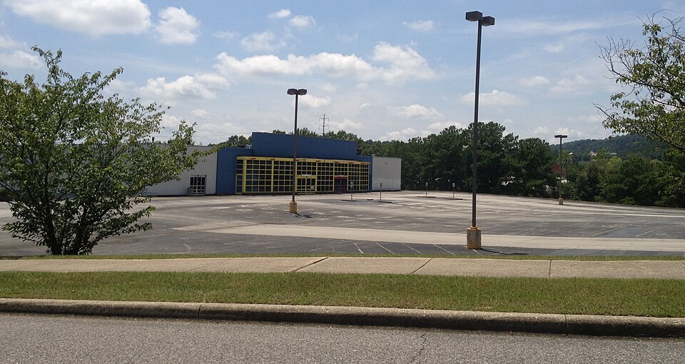 Eastwood MallBirmingham, ALDemolishedHeart of Huntsville MallHuntsville, AL · 2007Redeveloped · As of August 2021, only the SpringHill Suites is finished and open…Jessop's RiversideSheffield, ALRedeveloped · office park