Malls · Illinois
Lincoln Mall (Matteson)
Opened 1973. Closed 2015. Redeveloped.
Solid = from the authors' map · outlined = public source · dashed = model-written, not yet reviewed by a person. Tap any value's source label to see where it came from. documented = a quoted excerpt (click to read it) · reported = a source named, no excerpt yet · no source.
Site profile18 elements · what this retrofit is built with · tap a chip for the evidence
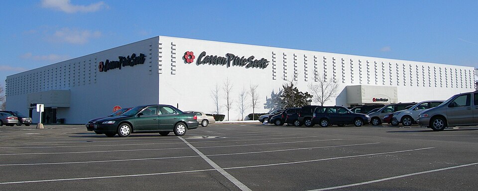
Carson Pirie Scott
This site: Carson Pirie Scott wikipedia · all sites with thisJCPenney
This site: JCPenney wikipedia · all sites with thisMontgomery Ward
This site: Montgomery Ward wikipedia · all sites with thisSears
This site: Sears wikipedia · all sites with thisWebsite dead or redirecting
This site: overture / http check · all sites with this30,000+ vehicles a day on an adjacent road
This site: 37,661 on Lincoln Hwy fhwa-hpms · all sites with thisBike network nearby
This site: 15 ways openstreetmap · all sites with thisCounty lost 10%+ of retail establishments since 2012
This site: -11% census-cbp · all sites with thisCounty permitting 2,000+ apartment units a year
This site: 4,853 units, Cook County census-bps · all sites with thisCounty typical rent $2,000+
This site: $2,228/mo zillow · all sites with thisGrocery within 800 m
This site: 1 stores openstreetmap · all sites with thisHigh inland flooding risk
This site: Relatively High fema-nri · all sites with thisHigh tornado risk
This site: Relatively High fema-nri · all sites with thisShrinking county
This site: -0.7% census-acs · all sites with thisWalkable block group (EPA ≥ 12)
This site: …index 14.2 epa-walkability · all sites with thisRedeveloped
This site: …vacant lot awaiting casino development extraction · all sites with thisCasino
This site: …vacant lot awaiting casino development extraction · all sites with thisEntertainment and sports
This site: …new_use field extraction · all sites with thisNow
| Status | Demolishedextracted, unreviewed |
|---|---|
| Strategy | Redevelopedextracted, unreviewed documentedA $115-million redevelopment process started in 2006 with hopes of attracting more retailers. |
| New uses | entertainmentextracted, unreviewed reported |
| What is there now | vacant lot awaiting casino developmentextracted, unreviewed documentedOn January 30, 2020, The City of Matteson approved a casino on the mall site, proposed by South Suburban Development LLC. |
Securitised debt and public filers
Filings (2001 to date) that name “Lincoln Mall” and “Matteson” (21 hits, first 21 sampled, 8 other filers such as tenants left out). Only weak matches to commercial-mortgage trusts: the mall may have backed a securitised loan, or may just be mentioned in the filing; several trusts usually means one loan split into pari-passu notes. Earliest trust filing in the sample 2002-04-03 (a sample date, not the issuance date); candidate loan vintage 2002 from the trust name (weak match). Whether the loan is still in the pool, in special servicing or repaid is in the trust's monthly distribution reports, which are not searchable here. Text matches, not a title search. Open the search · all trusts.
| Kind | Filer | Filings | Dates | Forms |
|---|---|---|---|---|
| CMBS trust (weak) | BEAR STEARNS COMMERCIAL MORTGAGE SECURITIES TRUST 2002 TOP6 | 1 | 2002-04-03 to 2002-04-03 | 8-K 1 |
Site context
| FEMA flood zone | X · AREA OF MINIMAL FLOOD HAZARDFEMA NFHL |
|---|---|
| EPA-regulated facilities within 500 m | 10: AMOCO 18605; CONTINENTAL BAKING CO; FIRESTONE SVC CTR; PENNEY OPCO LLC 2952; SAMS CLUB 8154EPA FRS |
| Census tract 17031830006 | 2,441 people, 1,095 per sq mi; median household income $60,000; median gross rent $421; 40% renters; 6.2% vacant units; 4.6% commute by transitACS 2023 5-year |
| Walkability (EPA, block group) | index 14.2 of 20; 86 intersections per sq mi; nearest transit stop 831 m; land-use mix 0.82; 119,481 jobs within 45 min by car, 28,241 by transit; 16% of households without a carEPA Smart Location |
| Within a 10–15 minute walk (800 m) | 3 of 6 daily needs: 1 grocers, 1 schools, 0 parks or playgrounds, 0 health, 0 civic, 17 food and drink; 15 cycleway segments, 30 sidewalk-tagged segmentsOpenStreetMap |
| Opportunity Zone | noHUD |
| Housing permits, Cook County (IL), 2024 | 4,853 units in 5+ unit buildings, 512 in 2–4, 1,142 single-family; 2023: 3,332 in 5+Census BPS |
| Social vulnerability (CDC SVI 2022, tract) | overall percentile 0.60; socioeconomic 0.58; housing and transport 0.48; 28% below 150% of poverty; 24% of households with no vehicleCDC/ATSDR |
| Other atlas sites nearby | 1 within 10 km, 8 within 25 km: Park Forest Plaza (4.6 km)computed |
| Overture Maps | place Party City Lincoln Mall (party_and_event_planning, confidence 0.85, from Microsoft, Overture)Overture (CDLA-Permissive 2.0) |
| Website and social | (down or redirecting, status None)Overture / Internet Archive |
| Attention: Wikipedia page views | 114,999 since 2015; 6,716 in the last 12 months (+3% vs the prior 12); peak 2016-11 with 8,191Wikimedia |
| Tract change 2013–2023 | population -6% (2,584 → 2,441); median income +14% ($52,468 → $60,000); renters 34% → 40%; median home value +37% ($119,200 → $162,800)Census ACS 5-year |
| Natural hazard risk (FEMA National Risk Index, tract) | relatively moderate overall (score 72.5); expected annual loss $1.7M; high: tornado, inland flooding, cold wave; community resilience relatively highFEMA NRI |
| Tax-credit housing within 1 km | noneHUD LIHTC |
| Retail trade in the county, 2025 (BLS QCEW) | 213,302 jobs in 12,604 establishments; average annual pay $43,743; employment location quotient 0.83; employment -0.6% on the yearBLS QCEW 2025, NAICS 44-45, private |
| Jobs located in the tract, 2022 | 4,334 jobs; 1,572 in retail trade, 445 in accommodation and food (workplace blocks summed to tract 17031830006)Census LEHD LODES8 WAC 2022 |
| Upward mobility (Opportunity Atlas, 2010 tract) | children of low-income (25th percentile) families reached the 42th income percentile as adults; 2.2% incarcerated at the 2010 count (232 children in the sample); born 1978–83, measured 2014–15Opportunity Insights |
| Food access (USDA FARA 2019, 2010 tract) | not a low-access tract at 1 mile; 4% of residents more than 1 mile from a supermarket; poverty rate 12.4%; median family income $60,625; 206 SNAP householdsUSDA ERS |
| Schools | Rich Township High School District 227 (09-12); 0 public schools within 1 mileNCES EDGE |
| Elevation | 701 ft above sea level at the site pointUSGS 3DEP |
| Storm events in the county, 2016-2025 | 1,091 county-logged events: 620 thunderstorm wind, 164 hail, 133 flood, 82 flash flood; $1,049,471,000 property damage reported; forecast-zone events (most flood, winter and heat) not countedNOAA Storm Events |
| Homes for sale in ZIP 60443, 2026-09 | median list price $271,450 (+2.4% on the year); 48 active listings; median 53 days on market; 15% with a price cutRealtor.com Research |
| Retail trade in the county, 2012 to 2023 | 13,577 establishments (-11%); 214,575 jobs (-4%)Census CBP |
| Housing market in the county | typical home value $340,258 (+6% 1 yr, +23% 5 yr); typical rent $2,228/mo (+5% 1 yr), 2026-09Zillow Research |
| House price index, tract, 2025 | 211 (2000 = 100); -15.6% 1 yr, +39% 5 yr, +89% 10 yrFHFA |
| Traffic on the busiest road within 600 m (2024) | 37,661 vehicles a day on Lincoln Hwy (principal arterial, 6 lanes); 1,625 trucks; 15 counted segmentsFHWA HPMS |
Summary, model-written
Lincoln Mall opened in 1973 with four major anchors and operated as a regional shopping center until the mid‑2000s. Anchor losses began with Wieboldt's closing in 1987, followed by JCPenney in 2000, and despite a 2006‑2007 redevelopment that brought Target and a returned JCPenney, the mall faced a court‑ordered sale and was closed permanently in January 2015. Demolition completed by summer 2017 left the site as a vacant lot awaiting casino development.
Why. The primary causes visible in the record are the sequential loss of anchor tenants (Wieboldt's, JCPenney) and the eventual court‑ordered sale that forced closure. No explicit mention of debt or broader competition is provided.
Where it stands. The site is currently a vacant lot awaiting casino development, with no controlling entity identified in the record.
For a planner
- Record lists a redevelopment strategy targeting entertainment use.
- After‑notes indicate the vacant lot is awaiting casino development.
- Opportunity score of 40 reflects the large 990k‑sf GLA but also the closed/demolished status.
- Data are marked as draft, suggesting limited verification.
For a developer
- Site size: 990,000 sq ft GLA (large parcel).
- Control/ownership not specified in the record.
- Entitlement stage: strategy marked as redevelop with intended new use of entertainment; after‑notes point to casino development pending.
- No context‑layer constraints (flood, transit, environment) are provided.
- Market signal: opportunity score 40, driven by large size but offset by closed/demolished status.
What we do not know yet
- Owner/controlling entity not recorded.
- Zoning or land‑use approvals for casino development not detailed.
- Financial structure or funding sources for the redevelopment are absent.
- Environmental or flood‑risk context layers are missing.
- Some fields (e.g., exact demolition date, sale price) are extraction‑based and marked as draft, indicating potential unreviewed data.
Generated by nvidia/nemotron-3-super-120b-a12b on NVIDIA API via Hermes CT from the fields, parcels, deals and context layers on this page, with no outside knowledge. It is regenerated when the record changes and has not been checked by a person. How it is made.
Similar sites
- Dixie Square Mall, Harvey, IL · Malls · opened 1966; closed 2012; same strategy: redevelop
- Northwest Mall, Houston, TX · Malls · similar GLA (794,144 sq ft); opened 1968; closed 2017
- Westland Mall, Columbus, OH · Malls · similar GLA (1,042,610 sq ft); opened 1969; closed 2017
- Westminster Mall, Westminster, CO · Malls · similar GLA (1,200,000 sq ft); opened 1977; closed 2011
Elsewhere on the web
Retail history: Lincoln Square Mall on DeadMalls.com photos, field notes and visitor memories since 2000; matched by name and state only, check the city; nothing copied here
Pages with photos
- Lincoln Mall Matteson IL. | Lincoln Mall first opened its do… | Flickr flickr.com
- Trip to the Mall: Lincoln Mall- ( Matteson, IL) triptothemall.blogspot.com
- Lincoln Mall - Royal Blue / XL localvyntage.com
- PHOTOS: Inside the abandoned Lincoln Mall in Matteson, 2 years afte… wgntv.com
- Long Dead Lincoln Mall in Matteson, Illinois youtube.com
- Lincoln Mall: Grand Opening August 9th 1973 karlasullivandotcom.wordpress.com
- Memories flood back 50 years after Lincoln Mall opening chicagotribune.com
- Eerie Video Gives Glimpse Inside Deserted Lincoln Mall | … patch.com
Search images: Google · Bing · Commons · references: ULI case studies · Google Scholar
Multifamily screen
- closed or demolished site (sourced)
- 990,000 sq ft GLA (large site)
Inputs: record fields (size, status) and county Census ACS 2018–2023 figures (growth, rent). How the points work. Not a recommendation.
History and original facts
| Opened | 1973Wikidata |
|---|---|
| Closed | 2015extracted, unreviewed documentedOn November 11, 2014, Cook County Judge Thomas Condon ordered that the mall be closed permanently as of January 7, 2015, with the exception of Carson's (whose building is owned separately by its parent company), which was to remain open. |
| Gross leasable area | 990,000 sq ftEsri 2014 layer reported |
| Stores at peak | 97Esri 2014 layer reported |
| Original developer | Randhurst Corporationextracted, unreviewed documentedThe center was developed by the Randhurst Corporation, the same developer consisting of Wieboldt's and Carson's executives who developed Randhurst Mall and Lakehurst Mall. |
| Anchors | JCPenney, Sears, Carson Pirie Scott, Montgomery Ward, Wieboldt's |
| Address | Rt. 30 & Cicero |
| County | Cook |
| Census division | 3 · East North Central |
| Notes | Wikipedia categories: Demolished shopping malls in the United States |
Not yet recorded: acres, retrofit year. Know it? Tell us.
Background
Lincoln Mall was a shopping mall located at the corner of U.S. Route 30 and Cicero Avenue in Matteson, Illinois, a south suburb of Chicago.
Excerpt from Wikipedia (authors and history), CC BY-SA 4.0. May be older than the record above.
Timeline
- 1973 Opened (Wikidata)
- 1973 Lincoln Mall opened with anchors Carson Pirie Scott, Montgomery Ward, Wieboldt's, and JCPenney
- 1987 Wieboldt's closed
- 1993 Mall renovated with new glass elevator
- 1995 Sears opened in former Wieboldt's location
- 2000 JCPenney closed
- 2006 $115‑million redevelopment process started
- 2007 Target opened and JCPenney returned on outparcels
- 2012 Court‑ordered sale by auction scheduled
- 2014 Judge ordered permanent closure effective Jan 7, 2015
- 2017 Demolition began and completed by end of summer
Sources
- Wikipedia: Lincoln Mall · supports: after notes, original developer, status, strategy, year closed
15 quoted sentences
On November 11, 2014, Cook County Judge Thomas Condon ordered that the mall be closed permanently as of January 7, 2015, with the exception of Carson's (whose building is owned separately by its parent company), which was to remain open.
The center was developed by the Randhurst Corporation, the same developer consisting of Wieboldt's and Carson's executives who developed Randhurst Mall and Lakehurst Mall.
On January 30, 2020, The City of Matteson approved a casino on the mall site, proposed by South Suburban Development LLC.
The mall itself, which closed in 2015, was demolished by 2018.
- Esri StoryMaps: Closed_US_Malls feature layer (2014) · 2014-10-02
More in Illinois
 MegamallChicago, IL · 2015Redeveloped · Redevelopment: residential mixed-use
 Park Forest PlazaPark Forest, IL · 2001Partial Redeveloped · Partial redevelopment: civic, residential, new streets
 Randhurst MallMount Prospect, IL · 2010Redeveloped · Redevelopment: mixed use, new streets
 Spring Hill MallWest Dundee, IL · 2015Partial Redeveloped · Partial redevelopment, open air streetSt Charles MallSt Charles, IL · 2016Redeveloped · Redevelopment: residential, new streets