Malls · Maryland
Laurel Mall
Opened 1979. Closed 2012. Redeveloped in 2015.
Solid = from the authors' map · outlined = public source · dashed = model-written, not yet reviewed by a person. Tap any value's source label to see where it came from. documented = a quoted excerpt (click to read it) · reported = a source named, no excerpt yet · no source.
Site profile17 elements · what this retrofit is built with · tap a chip for the evidence
Hecht's
This site: Hecht's wikipedia · all sites with thisJCPenney
This site: JCPenney wikipedia · all sites with thisMontgomery Ward
This site: Montgomery Ward wikipedia · all sites with thisOn Facebook
This site: …https://www.facebook.com/noodlesandcompany/ overture · all sites with thisWebsite alive
This site: …https://locations.noodles.com/md/laurel/14700-baltimore-ave overture / http check · all sites with this15-minute neighbourhood (5+ of 6 daily needs within 800 m)
This site: 6/6 openstreetmap · all sites with this30,000+ vehicles a day on an adjacent road
This site: 38,085 on 1 fhwa-hpms · all sites with thisBike network nearby
This site: 22 ways openstreetmap · all sites with thisGrocery within 800 m
This site: 7 stores openstreetmap · all sites with thisRenter-majority tract
This site: 70% census-acs · all sites with thisWalkable block group (EPA ≥ 12)
This site: …index 18.5 epa-walkability · all sites with thisTax increment financing
This site: …city site plan approval (zoning instrument not found) TIF figures conflict: $16M (deadmalls, 2009) versus $8.5M (Gree research-planning · all sites with thisRedeveloped
This site: Redevelopment: mixed use, new streets record · all sites with thisEntertainment and sports
This site: …new_use field extraction · all sites with thisHousing
This site: …new_use field extraction · all sites with thisMixed use
This site: Redevelopment: mixed use, new streets Approved by Laurel Mayor and City Council. ht extraction · all sites with thisRetail (continued)
This site: …new_use field extraction · all sites with thisFrom the authors' map
MD, Prince George’s County: Laurel Mall/Laurel Town Centre, 2015
• Redevelopment: mixed use, new streets
Now
| Status | Retrofit builtderived from authors' map (retrofit year present) reported |
|---|---|
| Strategy | Redevelopedauthors' map reported |
| New uses | housing, healthcare, retail, entertainment, otherextracted, unreviewed reported |
| What is there now | Redevelopment: mixed use, new streetsauthors' map reported |
| Retrofit year | 2015authors' map reported |
| Redeveloper | General Growth Propertiesextracted, unreviewed reported |
Planning
| Zoning change | city site plan approval (zoning instrument not found)research |
|---|---|
| Public purchase or subsidy | TIF figures conflict: $16M (deadmalls, 2009) versus $8.5M (Greenberg Gibbons case study).research documentedRenovation plans were unveiled to the public on January 30, 2007, at Laurel City Hall. |
| Entitlement year | 2012research reported |
| Planning notes | Approved by Laurel Mayor and City Council. https://www.ggcommercial.com/media/v1/443/2023/07/Towne-Centre-at-Laurel-Case-Study-1-min.pdfresearch reported |
Securitised debt and public filers
Filings (2001 to date) that name “Laurel Mall” and “Laurel” (148 hits, first 100 sampled, 5 other filers such as tenants left out). Only weak matches to commercial-mortgage trusts: the mall may have backed a securitised loan, or may just be mentioned in the filing; several trusts usually means one loan split into pari-passu notes. Earliest trust filing in the sample 2004-10-19 (a sample date, not the issuance date); candidate loan vintage 2004 from the trust name (weak match). Whether the loan is still in the pool, in special servicing or repaid is in the trust's monthly distribution reports, which are not searchable here. Text matches, not a title search. Open the search · all trusts.
| Kind | Filer | Filings | Dates | Forms |
|---|---|---|---|---|
| CMBS trust (weak) | Bear Stearns Commercial Mortgage Securities Trust 2007-PWR15 | 2 | 2007-04-13 to 2007-05-03 | 8-K 1, 8-K/A 1 |
| CMBS trust (weak) | CSFB COMMERCIAL MORT PASS THR CERTS SER 2004 C4 | 1 | 2004-10-19 to 2004-10-19 | 8-K 1 |
| Public owner (weak) | PENNSYLVANIA REAL ESTATE INVESTMENT TRUST | 39 | 2001-03-30 to 2009-08-10 | 8-K 19, 10-K 10, 10-Q 9, 8-K/A 1 |
| Public owner (weak) | NEW PLAN EXCEL REALTY TRUST INC | 27 | 2001-08-09 to 2009-03-31 | 8-K 18, 10-K 8, 10-Q 1 |
| Public owner (weak) | CROWN AMERICAN REALTY TRUST | 6 | 2001-11-02 to 2003-06-19 | 10-Q 3, 10-K 2, 8-K 1 |
| Public owner (weak) | KRAMONT REALTY TRUST | 5 | 2001-03-30 to 2005-03-16 | 10-K 5 |
Site context
| FEMA flood zone | X · AREA OF MINIMAL FLOOD HAZARDFEMA NFHL |
|---|---|
| EPA-regulated facilities within 500 m | 30: BIG TOP CLEANERS; BLEND MASTERS COLLISION CENTER; BURGER KING; CAR MATCH INC; CURRO,TOM-LINCOLN MERCURYEPA FRS |
| Census tract 24033800108 | 3,741 people, 10,577 per sq mi; median household income $81,026; median gross rent $1,865; 70% renters; 9.3% vacant units; 1.7% commute by transitACS 2023 5-year |
| Walkability (EPA, block group) | index 18.5 of 20; 218 intersections per sq mi; nearest transit stop 89 m; land-use mix 0.84; 183,796 jobs within 45 min by car, 52,265 by transit; 4% of households without a carEPA Smart Location |
| Within a 10–15 minute walk (800 m) | 6 of 6 daily needs: 7 grocers, 3 schools, 15 parks or playgrounds, 3 health, 3 civic, 47 food and drink; 22 cycleway segments, 58 sidewalk-tagged segmentsOpenStreetMap |
| Opportunity Zone | noHUD |
| Housing permits, Prince George County (MD), 2024 | 0 units in 5+ unit buildings, 0 in 2–4, 1,473 single-family; 2023: 1,356 in 5+Census BPS |
| Social vulnerability (CDC SVI 2022, tract) | overall percentile 0.54; socioeconomic 0.50; housing and transport 0.53; 15% below 150% of poverty; 5% of households with no vehicleCDC/ATSDR |
| Other atlas sites nearby | 0 within 10 km, 13 within 25 kmcomputed |
| Overture Maps | place Laurel Town Center (restaurant, confidence 0.80, from AllThePlaces, Overture); building footprint 17,300 m², 2.8945422172546387 mOverture (CDLA-Permissive 2.0) |
| Website and social | locations.noodles.com (alive) · social: , facebookOverture / Internet Archive |
| Attention: Wikipedia page views | 43,590 since 2015; 3,092 in the last 12 months (-4% vs the prior 12); peak 2015-08 with 548Wikimedia |
| Tract change 2013–2023 | population +19% (3,143 → 3,741); median income +26% ($64,554 → $81,026); renters 75% → 70%; median home value +16% ($269,200 → $312,300)Census ACS 5-year |
| Natural hazard risk (FEMA National Risk Index, tract) | very low overall (score 3.1); expected annual loss $379,877; community resilience relatively lowFEMA NRI |
| Tax-credit housing within 1 km | noneHUD LIHTC |
| Retail trade in the county, 2025 (BLS QCEW) | 35,827 jobs in 2,261 establishments; average annual pay $43,372; employment location quotient 1.10; employment -1.4% on the yearBLS QCEW 2025, NAICS 44-45, private |
| Jobs located in the tract, 2022 | 2,116 jobs; 702 in retail trade, 628 in accommodation and food (workplace blocks summed to tract 24033800108)Census LEHD LODES8 WAC 2022 |
| Upward mobility (Opportunity Atlas, 2010 tract) | children of low-income (25th percentile) families reached the 38th income percentile as adults; 2.2% incarcerated at the 2010 count (456 children in the sample); born 1978–83, measured 2014–15Opportunity Insights |
| Food access (USDA FARA 2019, 2010 tract) | not a low-access tract at 1 mile; poverty rate 10.9%; median family income $65,789; 99 SNAP householdsUSDA ERS |
| Schools | Prince George's County Public Schools (PK-12); 2 public schools within 1 mile: Laurel Elementary; Laurel HighNCES EDGE |
| Elevation | 180 ft above sea level at the site pointUSGS 3DEP |
| Storm events in the county, 2016-2025 | 361 county-logged events: 230 thunderstorm wind, 72 flood, 42 flash flood, 16 hail; $2,967,250 property damage reported; forecast-zone events (most flood, winter and heat) not countedNOAA Storm Events |
| Homes for sale in ZIP 20707, 2026-09 | median list price $407,500 (+0.0% on the year); 91 active listings; median 49 days on market; 17% with a price cutRealtor.com Research |
| Retail trade in the county, 2012 to 2023 | 2,230 establishments (+0%); 37,184 jobs (+2%)Census CBP |
| Housing market in the county | typical home value $421,250 (-1% 1 yr, +7% 5 yr); typical rent $1,957/mo (+2% 1 yr), 2026-09Zillow Research |
| House price index, tract, 2022 | 293 (2000 = 100); +12.7% 1 yr, +85% 10 yrFHFA |
| Traffic on the busiest road within 600 m (2024) | 38,085 vehicles a day on 1 (principal arterial, 5 lanes); 1,393 trucks; 32 counted segmentsFHWA HPMS |
Similar sites
- Rockville Mall, Rockville, MD · Malls · opened 1972; same strategy: redevelop; also in MD
- Owings Mills Mall, Owings Mills, MD · Malls · opened 1986; closed 2015; same strategy: redevelop
- Cloverleaf Mall, Richmond, VA · Malls · opened 1972; closed 2008; same strategy: redevelop
- Parole Plaza, Annapolis, MD · Malls · same strategy: redevelop; also in MD; 30 km away
Elsewhere on the web
Retail history: Laurel Mall on DeadMalls.com photos, field notes and visitor memories since 2000; matched by name and city; nothing copied here
Pages with photos
- Laurel Mall and Laurel,MD. | Front entrance off Rt. 1. Fro… flickr.com
- Laurel Mall (Maryland) - Alchetron, The Free Social Encyclopedia alchetron.com
- Locations Hub - Laurel Mall rs.locationshub.com
- Anticipating Laurel Malls, Past and Present | Lost Laurel lostlaurel.com
- Laurel Mall Macy's Set To Close | Laurel, MD Patch patch.com
Search images: Google · Bing · Commons · references: ULI case studies · Google Scholar
Multifamily screen
- retrofit already built
- county grew 5.4% 2018–23
- median rent $1,761
- housing in the record
Inputs: record fields (size, status) and county Census ACS 2018–2023 figures (growth, rent). How the points work. Not a recommendation.
History and original facts
| Now called / also known as | Laurel Town Centre |
|---|---|
| Opened | 1979Wikidata |
| Closed | 2012extracted, unreviewed |
| Stores at peak | 120extracted, unreviewed reported |
| Original developer | Shopco Inc.extracted, unreviewed |
| Anchors | JCPenney, Montgomery Ward, Hecht's |
| County | Prince George's County |
| Census division | 5 · South Atlantic |
Not yet recorded: acres, GLA. Know it? Tell us.
Background
Laurel Mall was a shopping mall located on the west side of U.S. Route 1 in Laurel, Maryland. The mall opened on October 11, 1979 and connected two pre-existing structures – the freestanding Montgomery Ward on its south side and Laurel Shopping Center to the north. The mall closed permanently on May 1, 2012.
Excerpt from Wikipedia (authors and history), CC BY-SA 4.0. May be older than the record above.
Timeline
- 1969 Montgomery Ward store opened as stand-alone
- 1979 Opened (Wikidata)
- 1979 Mall opened
- 1981 Hecht's added as third anchor
- 1991 Mall received $2 million face lift and update
- 2001 Montgomery Ward went out of business
- 2002 JC Penney vacated the mall
- 2006 Sold to Somera Capital Management for $31 million
- 2007 Renovation plans unveiled to public
- 2011 GGC took partial ownership and began managing mall
- 2012 Mall closed permanently
- 2015 Retrofit: redevelop
Sources
- Wikipedia · supports: original developer, public subsidy, year closed
13 quoted sentences
The mall closed permanently on May 1, 2012
The Laurel Centre Mall was developed by Shopco Inc.
Renovation plans were unveiled to the public on January 30, 2007, at Laurel City Hall.
The 167,000-square-foot (15,500 m2) Montgomery Ward store opened for business on April 16, 1969, as a stand-alone business.
- deadmalls.com · supports: zoning change
1 quoted sentence
The project secured $8.5 million in Tax Increment Financing.
- ggcommercial.com
- Retrofitting Suburbia Interactive Mall Map (ArcGIS web map ce33ab26…) · 2021-01-20
More in Maryland
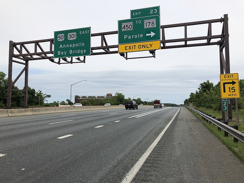 Parole PlazaAnnapolis, MD · 2009Redeveloped · Redevelopment: mixed use
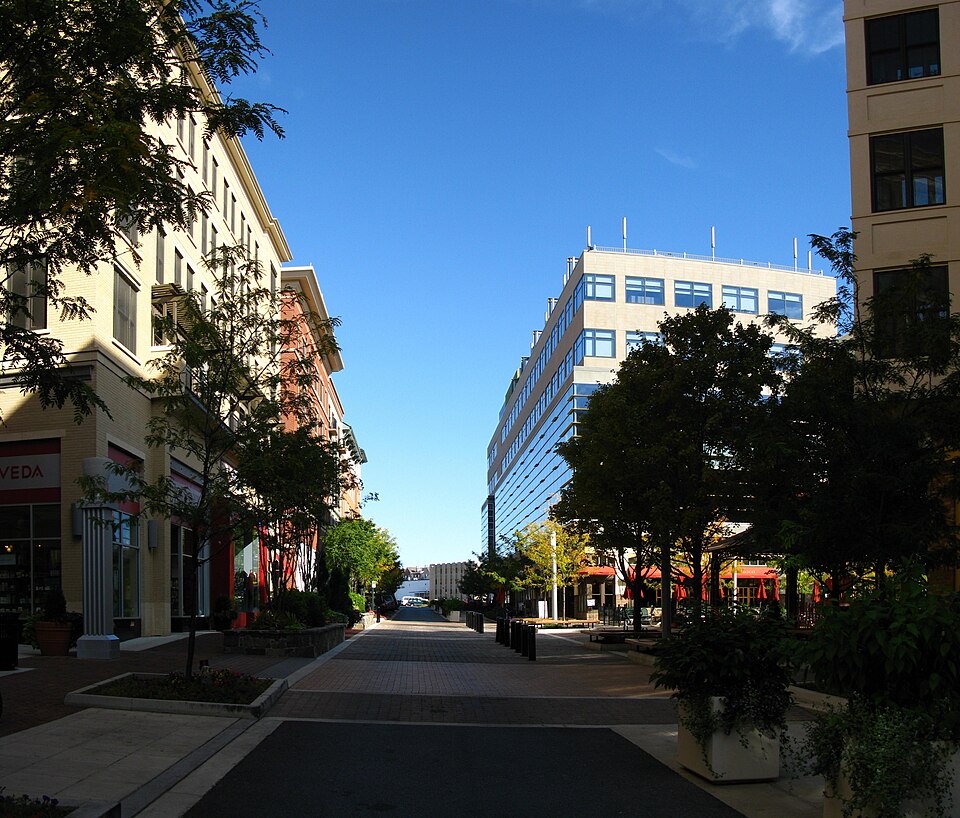 Rockville MallRockville, MD · 2008Redeveloped · Redevelopment: mixed use, new streets
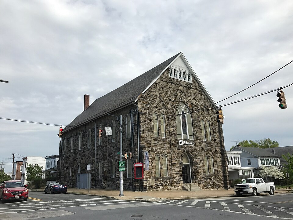 Rotunda MallBaltimore, MD · 2013Redeveloped · Redevelopment: mixed use