Malls · Ohio
Forest Fair Mall
Forest Fair Mall opened 1989, renamed Cincinnati Mills 2002, closed 2022, demolished 2025‑2026; site cleared under Simon Property Group ownership. · summary, model-written
Solid = from the authors' map · outlined = public source · dashed = model-written, not yet reviewed by a person. Tap any value's source label to see where it came from. documented = a quoted excerpt (click to read it) · reported = a source named, no excerpt yet · no source.
Site profile12 elements · what this retrofit is built with · tap a chip for the evidence
Elder-Beerman
This site: Elder-Beerman wikipedia · all sites with thisClosed or demolished, no retrofit recorded
This site: …demolished extraction · all sites with thisHigh attention (20k+ Wikipedia views a year)
This site: 32,409 wikimedia · all sites with thisOn Facebook
This site: …https://www.facebook.com/108054261932395 overture · all sites with thisWebsite alive
This site: …https://www.facebook.com/groups/bourbonstreetnightclub overture / http check · all sites with this30,000+ vehicles a day on an adjacent road
This site: 104,404 on IR 275 fhwa-hpms · all sites with thisCounty lost 10%+ of retail establishments since 2012
This site: -11% census-cbp · all sites with thisGrocery within 800 m
This site: 3 stores openstreetmap · all sites with thisHigh tornado risk
This site: Relatively High fema-nri · all sites with thisInterstate or freeway within 600 m
This site: IR 275 fhwa-hpms · all sites with thisTract house prices doubled in 10 years
This site: +143% fhfa · all sites with thisWalkable block group (EPA ≥ 12)
This site: …index 14.3 epa-walkability · all sites with thisNow
| Status | Demolishedextracted, unreviewed documentedDemolition of the entire complex began in September 2025, and was completed in March 2026. |
|---|
Deals and debt
| Date | Event | Price | Parties | Source |
|---|---|---|---|---|
| Sold | — | Simon Property Group ← Mills Corporation | Wikipedia |
Site context
| FEMA flood zone | X · AREA OF MINIMAL FLOOD HAZARDFEMA NFHL |
|---|---|
| EPA-regulated facilities within 500 m | 4: CPI PHOTO FINISH; KIDDIE KANDIDS #000574; MEIJER NO 159; PETCO STORE #2828EPA FRS |
| Census tract 39061021506 | 3,584 people, 4,027 per sq mi; median household income $64,144; median gross rent $1,291; 32% renters; 0.0% vacant units; 0.0% commute by transitACS 2023 5-year |
| Walkability (EPA, block group) | index 14.3 of 20; 116 intersections per sq mi; nearest transit stop 844 m; land-use mix 0.85; 89,805 jobs within 45 min by car, 21,614 by transit; 2% of households without a carEPA Smart Location |
| Within a 10–15 minute walk (800 m) | 4 of 6 daily needs: 3 grocers, 0 schools, 2 parks or playgrounds, 0 health, 1 civic, 14 food and drink; 0 cycleway segments, 40 sidewalk-tagged segmentsOpenStreetMap |
| Opportunity Zone | noHUD |
| Housing permits, Hamilton County (OH), 2024 | 217 units in 5+ unit buildings, 39 in 2–4, 566 single-family; 2023: 654 in 5+Census BPS |
| Social vulnerability (CDC SVI 2022, tract) | overall percentile 0.73; socioeconomic 0.54; housing and transport 0.66; 13% below 150% of poverty; 2% of households with no vehicleCDC/ATSDR |
| Other atlas sites nearby | 2 within 10 km, 9 within 25 km: Tri-County Mall (4.9 km); Northgate Mall (9.5 km)computed |
| Overture Maps | place Bourbon Street Memories - Forest Fair Mall (dance_club, confidence 0.58, from Overture, meta); building footprint 4,214 m², 8.548187255859375 mOverture (CDLA-Permissive 2.0) |
| Website and social | www.facebook.com (alive); archived 1998–2026 (Wayback) · social: facebookOverture / Internet Archive |
| Attention: Wikipedia page views | 70,026 since 2015; 32,409 in the last 12 months (-1% vs the prior 12); peak 2026-01 with 5,245Wikimedia |
| Tract change 2013–2023 | population +5% (3,407 → 3,584); median income +42% ($45,000 → $64,144); renters 23% → 32%; median home value +53% ($106,000 → $162,500)Census ACS 5-year |
| Natural hazard risk (FEMA National Risk Index, tract) | very low overall (score 15.4); expected annual loss $694,513; high: tornado; community resilience relatively highFEMA NRI |
| Tax-credit housing within 1 km | noneHUD LIHTC |
| Retail trade in the county, 2025 (BLS QCEW) | 38,928 jobs in 2,586 establishments; average annual pay $39,344; employment location quotient 0.77; employment -1.1% on the yearBLS QCEW 2025, NAICS 44-45, private |
| Jobs located in the tract, 2022 | 825 jobs; 301 in retail trade, 321 in accommodation and food (workplace blocks summed to tract 39061021506)Census LEHD LODES8 WAC 2022 |
| Upward mobility (Opportunity Atlas, 2010 tract) | children of low-income (25th percentile) families reached the 35th income percentile as adults; 3.7% incarcerated at the 2010 count (465 children in the sample); born 1978–83, measured 2014–15Opportunity Insights |
| Food access (USDA FARA 2019, 2010 tract) | not a low-access tract at 1 mile; poverty rate 8.4%; median family income $70,260; 100 SNAP householdsUSDA ERS |
| Schools | Northwest Local School District (PK-12); 0 public schools within 1 mileNCES EDGE |
| Elevation | 841 ft above sea level at the site pointUSGS 3DEP |
| Storm events in the county, 2016-2025 | 324 county-logged events: 147 thunderstorm wind, 71 flash flood, 57 hail, 41 flood; $6,576,950 property damage reported; 2 direct deaths; forecast-zone events (most flood, winter and heat) not countedNOAA Storm Events |
| Homes for sale in ZIP 45240, 2026-09 | median list price $294,000 (+9.9% on the year); 50 active listings; median 36 days on market; 25% with a price cutRealtor.com Research |
| Retail trade in the county, 2012 to 2023 | 2,518 establishments (-11%); 40,920 jobs (-26%)Census CBP |
| Housing market in the county | typical home value $266,241 (+1% 1 yr, +24% 5 yr); typical rent $1,468/mo (+2% 1 yr), 2026-09Zillow Research |
| House price index, tract, 2025 | 348 (2000 = 100); +1.9% 1 yr, +54% 5 yr, +143% 10 yrFHFA |
| Traffic on the busiest road within 600 m (2024) | 104,404 vehicles a day on IR 275 (Interstate, 6 lanes); 13,154 trucks; 20 counted segmentsFHWA HPMS |
Summary, model-written
Forest Fair Mall opened in 1989 after development by Amega, underwent ownership changes to LJ Hooker and Mills Corporation, which renamed it Cincinnati Mills in 2002 and renovated it in 2004. The mall closed to the public in 2022 (except Kohl's and Bass Pro Shops), demolition began in 2025 and was completed in 2026, leaving the site demolished.
Why. The record does not specify the causes of closure or demolition; no anchor losses, competition, debt, or other factors are mentioned.
Where it stands. The site is now demolished; Simon Property Group is listed as the owner after acquiring it from Mills Corporation.
For a planner
- Precedent: Mills Corporation rebranded the mall as Cincinnati Mills in 2002 and renovated it in 2004 before eventual closure.
- No policy tools or public incentives are noted in the record for this site.
- Open questions include future zoning, land‑use planning, and what will replace the cleared parcel.
For a developer
- Control: Simon Property Group is recorded as the owner following its purchase from Mills Corporation.
- Entitlement stage: The parcel is cleared after demolition (completed 2026), so no existing structures remain, but any new development would require fresh entitlements.
- Site size, flood risk, transit access, environmental constraints, and local market signals are not provided in the record.
What we do not know yet
- Key missing facts: exact site acreage, parcel boundaries, and current zoning designation.
- Environmental conditions (e.g., soil contamination, floodplain status) and transit proximity are not described.
- Market context such as surrounding tract data, demand for retail or alternative uses, and comparable sales are absent.
- The record’s verification status is 'draft' and its opportunity score is low (25), indicating limited confidence in the data.
- Details of any demolition remediation, utility infrastructure, or pending approvals for redevelopment are not stated.
Generated by nvidia/nemotron-3-super-120b-a12b on NVIDIA API via Hermes CT from the fields, parcels, deals and context layers on this page, with no outside knowledge. It is regenerated when the record changes and has not been checked by a person. How it is made.
Similar sites
- Northgate Mall, Northgate, OH · Malls · closed 2026; also in OH; 9 km away
- Burlington Center, Burlington Township, NJ · Malls · opened 1982; closed 2018
- Crystal River Mall, Crystal River, FL · Malls · opened 1990; closed 2022
- Foothills Mall, Casas Adobes, AZ · Malls · opened 1982; closed 2023
Elsewhere on the web
Retail history: Forest Fair Mall on DeadMalls.com photos, field notes and visitor memories since 2000; matched by name and state only, check the city; nothing copied here
Pages with photos
- Ohio abandoned malls: Forest Fair Mall could be demolished cincinnati.com
- Developer: Forest Fair Mall site demolition to include everythin… journal-news.com
- Forest Fair Mall, Fairfield, OH -- Nov 1995 | Todd Jacobson | Flickr flickr.com
- Forest Fair Mall Pt. 3 | The First "Supermall" is now The World's Largest Abandoned Mall | ExLog 118 youtube.com
- Forest Fair Mall - Wikipedia en.wikipedia.org
- DeadMalls.com deadmalls.com
- Forest Fair Mall In Fairfield, OH: Five Names In 35 Years Of Retail ... bestattractions.org
- Forest Fair Mall/Cincinnati Mills questions (Hamilton, Northgat… city-data.com
Search images: Google · Bing · Commons · references: ULI case studies · Google Scholar
Multifamily screen
- closed or demolished site (sourced)
Inputs: record fields (size, status) and county Census ACS 2018–2023 figures (growth, rent). How the points work. Not a recommendation.
History and original facts
| Opened | 1989Wikidata |
|---|---|
| Closed | 2022extracted, unreviewed documentedFollowing years of losing tenants, it closed to the public in December 2022, with the exception of Kohl's and Bass Pro Shops. |
| Stores at peak | 200extracted, unreviewed reported |
| Original developer | Amegaextracted, unreviewed documentedIn 1985, real estate developer Amega selected the site at the northeast corner of the Interstate 275 beltway's interchange with Winton Road in suburban Cincinnati, Ohio, for the development of a retail property. |
| Architect | Hellmuth, Obata + Kassabaum |
| Anchors | Bigg's, Kohl's, Elder-Beerman, Bonwit Teller, Parisian, Higbee's, B. Altman and Company, Sakowitz |
| County | Hamilton County |
| Census division | 3 · East North Central |
| Notes | Wikipedia categories: Demolished shopping malls in the United States |
Not yet recorded: acres, GLA, what is there now, retrofit year. Know it? Tell us.
Background
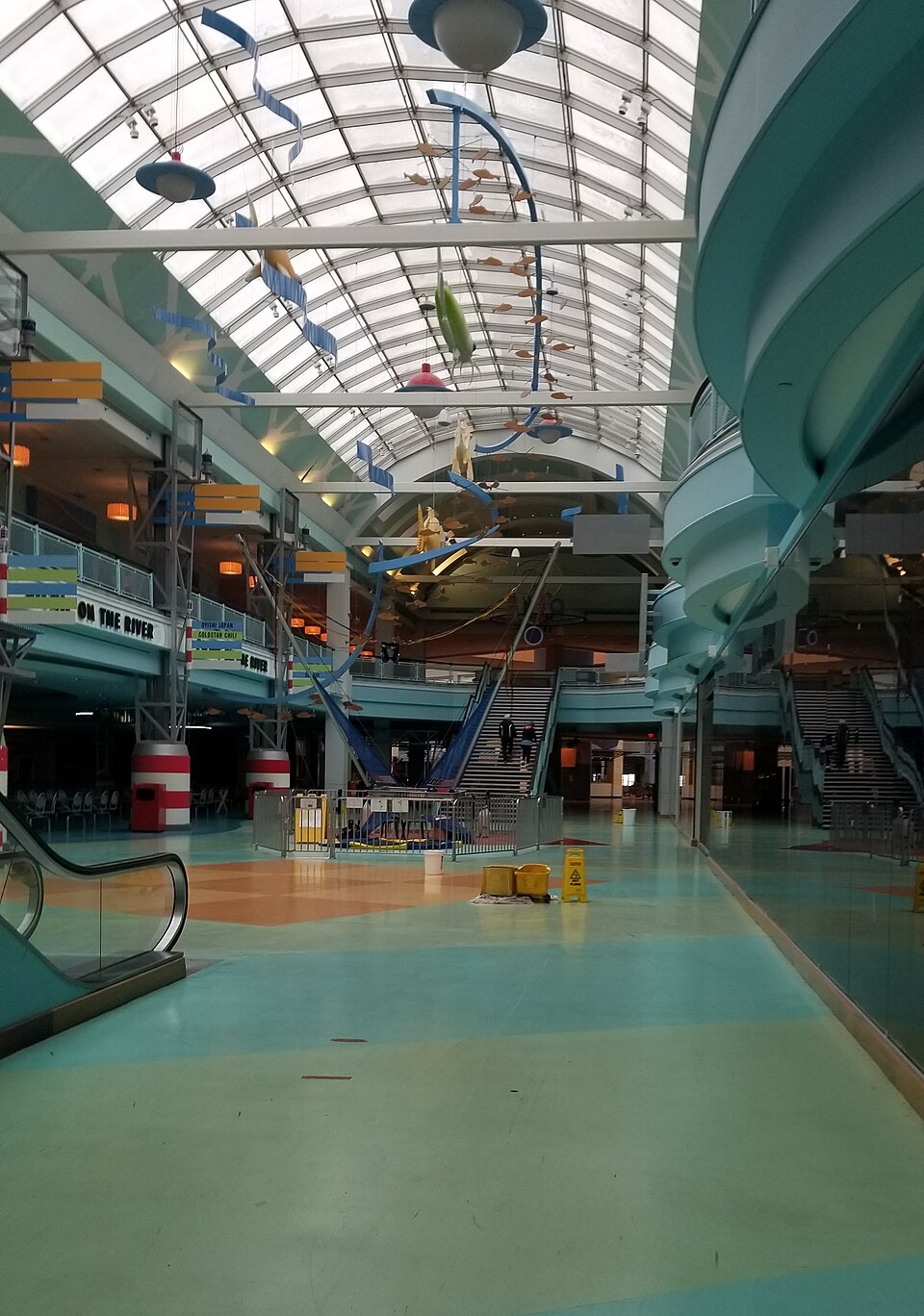
Forest Fair Mall was a super-regional shopping mall in the northern suburbs of Cincinnati, Ohio, United States. It was located on the border between Forest Park and Fairfield, at the junction of Interstate 275 and Winton Road.
Excerpt from Wikipedia (authors and history), CC BY-SA 4.0. May be older than the record above.
Timeline
- 1985 Amega selects site for development
- 1986 LJ Hooker acquires property from Amega
- 1988 First phase of mall opens (Bigg's and ~20 stores)
- 1989 Opened (Wikidata)
- 1989 Remainder of mall opens
- 2002 Mills Corporation renames property Cincinnati Mills
- 2004 Mills Corporation renovates mall in August 2004
- 2022 Mall closes to public (except Kohl's and Bass Pro Shops)
- 2025 Demolition begins
- 2026 Demolition completed
Sources
- Wikipedia: Forest Fair Mall · supports: original developer, status, year closed
12 quoted sentences
Following years of losing tenants, it closed to the public in December 2022, with the exception of Kohl's and Bass Pro Shops.
In 1985, real estate developer Amega selected the site at the northeast corner of the Interstate 275 beltway's interchange with Winton Road in suburban Cincinnati, Ohio, for the development of a retail property.
Demolition of the entire complex began in September 2025, and was completed in March 2026.
In 1985, real estate developer Amega selected the site at the northeast corner of the Interstate 275 beltway's interchange with Winton Road in suburban Cincinnati, Ohio, for the development of a retail property.
More in Ohio
 Portside Festival MarketplaceToledo, OH · 1997Reinhabited · Reinhabitation: science museum
 Richland MallOntario, OH · 2015Partial Reinhabited · Partial reinhabitation: healthcare