Malls · District of Columbia
Waterfront Mall
Redeveloped · Regreened in 2007. · from the fields below
Solid = from the authors' map · outlined = public source · dashed = model-written, not yet reviewed by a person. Tap any value's source label to see where it came from.
Site profile19 elements · what this retrofit is built with · tap a chip for the evidence
On Facebook
This site: …https://www.facebook.com/1721344308096339 overture · all sites with thisWebsite dead or redirecting
This site: …https://www.lexandleowaterfront.com/ overture / http check · all sites with this15-minute neighbourhood (5+ of 6 daily needs within 800 m)
This site: 6/6 openstreetmap · all sites with this200+ tax-credit housing units within 1 km
This site: 648 units in 1 properties hud-lihtc · all sites with this3+ other atlas sites within 10 km
This site: 28 within 10 km computed · all sites with this30,000+ vehicles a day on an adjacent road
This site: 147,295 on INTERSTATE 395 BN fhwa-hpms · all sites with thisBike network nearby
This site: 171 ways openstreetmap · all sites with thisCounty typical rent $2,000+
This site: $2,484/mo zillow · all sites with thisGrocery within 800 m
This site: 2 stores openstreetmap · all sites with thisHigh heat wave risk
This site: Relatively High fema-nri · all sites with thisHigh inland flooding risk
This site: Relatively High fema-nri · all sites with thisHigh-income tract ($100k+)
This site: $100,194 census-acs · all sites with thisInterstate or freeway within 600 m
This site: INTERSTATE 395 BN fhwa-hpms · all sites with thisNational Register place within 500 m
This site: Titanic Memorial; Law, Thomas, House nps-nrhp · all sites with thisRenter-majority tract
This site: 95% census-acs · all sites with thisShrinking county
This site: -1.8% census-acs · all sites with thisRedeveloped
This site: Redevelopment: mixed use, restored street Partial regreening: green roofs arcgis-webmap · all sites with thisRegreened
This site: Redevelopment: mixed use, restored street Partial regreening: green roofs arcgis-webmap · all sites with thisMixed use
This site: Redevelopment: mixed use, restored street Partial regreening: green roofs arcgis-webmap · all sites with thisFrom the authors' map
DC, Washington: Waterfront Mall/ Waterfront Station, 2007
• Redevelopment: mixed use, restored street
• Partial regreening: green roofs
Now
| Status | Retrofit builtderived from authors' map (retrofit year present) |
|---|---|
| Strategy | Redeveloped · Regreenedauthors' map |
| What is there now | Redevelopment: mixed use, restored street Partial regreening: green roofsauthors' map |
| Retrofit year | 2007authors' map |
Securitised debt and public filers
Filings (2001 to date) that name “Waterfront Mall” and “Washington” (3 hits, first 3 sampled). No commercial-mortgage trust names this mall in the sample, which does not rule out a securitised loan. Text matches, not a title search. Open the search · all trusts.
| Kind | Filer | Filings | Dates | Forms |
|---|---|---|---|---|
| Public owner (weak) | FOREST CITY ENTERPRISES INC | 2 | 2010-02-04 to 2011-04-05 | 8-K 2 |
| Public owner (weak) | BRESLER & REINER INC | 1 | 2005-01-21 to 2005-01-21 | 8-K 1 |
Site context
| FEMA flood zone | X · AREA OF MINIMAL FLOOD HAZARDFEMA NFHL |
|---|---|
| EPA-regulated facilities within 500 m | 34: AMIDON BOWEN; BANK OF AMERICA - SOUTHWEST - BAL; CHANNEL INN; CVS PHARMACY #10415; CVS PHARMACY #1348EPA FRS |
| Census tract 11001010201 | 2,946 people, 43,630 per sq mi; median household income $100,194; median gross rent $2,487; 95% renters; 14.5% vacant units; 30.5% commute by transitACS 2023 5-year |
| Within a 10–15 minute walk (800 m) | 6 of 6 daily needs: 2 grocers, 2 schools, 46 parks or playgrounds, 4 health, 12 civic, 58 food and drink; 171 cycleway segments, 392 sidewalk-tagged segmentsOpenStreetMap |
| Opportunity Zone | noHUD |
| National Register places within 500 m | 9: Titanic Memorial; Law, Thomas, House; Wheat Row; Duncanson-Cranch HouseNPS |
| Housing permits, Washington DC (DC), 2024 | 1,506 units in 5+ unit buildings, 85 in 2–4, 146 single-family; 2023: 2,779 in 5+Census BPS |
| Social vulnerability (CDC SVI 2022, tract) | overall percentile 0.28; socioeconomic 0.32; housing and transport 0.78; 7% below 150% of poverty; 49% of households with no vehicleCDC/ATSDR |
| Other atlas sites nearby | 28 within 10 km, 48 within 25 km: Center Market, Washington, D.C. (1.7 km); Old Post Office Pavilion (2.0 km); The Shops at National Place (2.4 km); Greenleaf Gardens (2.5 km); Kelly Miller Walk-Ups (2.5 km)computed |
| Overture Maps | place Leo at Waterfront Station Apartments (historic_site, confidence 0.97, from Overture, Overture-signals, meta); building footprint 8,234 m², 35.3 mOverture (CDLA-Permissive 2.0) |
| Website and social | www.lexandleowaterfront.com (down or redirecting, status 403); archived 2020–2025 (Wayback) · social: facebookOverture / Internet Archive |
| Tract change 2013–2023 | tract boundary changed between the 2010 and 2020 census; no 2013 comparisonCensus ACS |
| Natural hazard risk (FEMA National Risk Index, tract) | relatively moderate overall (score 80.6); expected annual loss $3.4M; high: inland flooding, heat wave; community resilience very highFEMA NRI |
| Tax-credit housing within 1 km | 1 LIHTC properties, 648 units: Capitol Park Plaza (648 units)HUD LIHTC |
| Retail trade in the county, 2012 to 2023 | 1,653 establishments (-5%); 21,170 jobs (+4%)Census CBP |
| Housing market in the county | typical home value $567,289 (-1% 1 yr, -10% 5 yr); typical rent $2,484/mo (+1% 1 yr), 2026-09Zillow Research |
| Traffic on the busiest road within 600 m (2024) | 147,295 vehicles a day on INTERSTATE 395 BN (Interstate, 6 lanes); 2,612 trucks; 40 counted segmentsFHWA HPMS |
Similar sites
- Laurel Mall, Laurel, MD · Malls · same strategy: redevelop; 28 km away
- Rockville Mall, Rockville, MD · Malls · same strategy: redevelop; 26 km away
- Ballston Commons, Arlington, VA · Malls · same strategy: redevelop, regreen; 8 km away
- Columbia Mall, Columbia, MD · Malls · same strategy: redevelop; 40 km away
Elsewhere on the web
Pages with photos
- Washington, DC Waterfront Station (Waterside Mall) | Flickr flickr.com
- Waterfront Mall – World-Wide Matel johnmatel.com
Search images: Google · Bing · Commons · references: ULI case studies · Google Scholar
Multifamily screen
- retrofit already built
- median rent $1,900
Inputs: record fields (size, status) and county Census ACS 2018–2023 figures (growth, rent). How the points work. Not a recommendation.
History and original facts
| Now called / also known as | Waterfront Station |
|---|---|
| County | District of Columbia |
| Census division | 5 · South Atlantic |
Not yet recorded: acres, GLA, year opened, original developer. Know it? Tell us.
Timeline
- 2007 Retrofit: redevelop, regreen
Sources
More in District of Columbia
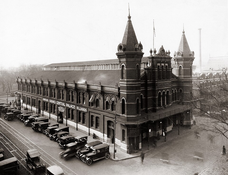 Center Market, Washington, D.C.Washington, DC · 1931DemolishedFort Dupont AdditionsWashington, DCRedevelopment, proposed · completely torn down and rebuiltGreenleaf AdditionsWashington, DCRedevelopment, proposed · completely torn down and rebuiltGreenleaf GardensWashington, DCRedevelopment, proposed · completely torn down and rebuilt