Malls · Ohio
Swifton Center
Opened 1956 as Cincinnati’s first mall, declined early 1980s after Kroger left and maintenance lapsed; current status unknown. · summary, model-written
Solid = from the authors' map · outlined = public source · dashed = model-written, not yet reviewed by a person. Tap any value's source label to see where it came from. documented = a quoted excerpt (click to read it) · reported = a source named, no excerpt yet · no source.
Site profile11 elements · what this retrofit is built with · tap a chip for the evidence
Elder-Beerman
This site: Elder-Beerman wikipedia · all sites with this15-minute neighbourhood (5+ of 6 daily needs within 800 m)
This site: 6/6 openstreetmap · all sites with this200+ tax-credit housing units within 1 km
This site: 1,479 units in 3 properties hud-lihtc · all sites with this3+ other atlas sites within 10 km
This site: 5 within 10 km computed · all sites with thisCounty lost 10%+ of retail establishments since 2012
This site: -11% census-cbp · all sites with thisGrocery within 800 m
This site: 1 stores openstreetmap · all sites with thisHigh heat wave risk
This site: Relatively High fema-nri · all sites with thisHigh tornado risk
This site: Relatively High fema-nri · all sites with thisOpportunity Zone
This site: 39061006300 hud-oz · all sites with thisTract house prices doubled in 10 years
This site: +165% fhfa · all sites with thisWalkable block group (EPA ≥ 12)
This site: …index 13.2 epa-walkability · all sites with thisNow
| Status | Status not verifiedWikidata reported |
|---|
Site context
| Transit within 800 m | no rail station; 9 bus stops within 400 mOpenStreetMap |
|---|---|
| Motorway junctions within 2 km | 1, 10A, 2, 27BOpenStreetMap |
| FEMA flood zone | X · AREA OF MINIMAL FLOOD HAZARDFEMA NFHL |
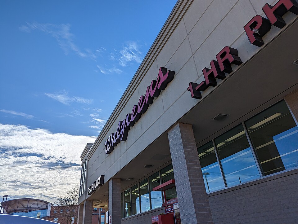
| EPA-regulated facilities within 500 m | 5: BP OIL CO SITE 01933; ELDER BEERMAN; FAMILY DOLLAR #3169; KROGER STORE 388; WALGREENS #5716EPA FRS |
| Census tract 39061006300 | 3,782 people, 6,091 per sq mi; median household income $60,774; median gross rent $1,002; 34% renters; 12.9% vacant units; 5.0% commute by transitACS 2023 5-year |
| Walkability (EPA, block group) | index 13.2 of 20; 115 intersections per sq mi; nearest transit stop 334 m; land-use mix 0.6; 85,909 jobs within 45 min by car, 96,339 by transit; 0% of households without a carEPA Smart Location |
| Within a 10–15 minute walk (800 m) | 6 of 6 daily needs: 1 grocers, 2 schools, 24 parks or playgrounds, 1 health, 2 civic, 3 food and drink; 6 cycleway segments, 38 sidewalk-tagged segmentsOpenStreetMap |
| Opportunity Zone | yes, tract 39061006300 (rural)HUD |
| Housing permits, Hamilton County (OH), 2024 | 217 units in 5+ unit buildings, 39 in 2–4, 566 single-family; 2023: 654 in 5+Census BPS |
| Social vulnerability (CDC SVI 2022, tract) | overall percentile 0.73; socioeconomic 0.59; housing and transport 0.70; 21% below 150% of poverty; 8% of households with no vehicleCDC/ATSDR |
| Other atlas sites nearby | 5 within 10 km, 11 within 25 km: Surrey Square Mall (3.2 km); St. Bernard Square (3.7 km); Kenwood Plaza (7.6 km); CIC Industrial Park (8.9 km); Cincinnati–Blue Ash Airport (9.2 km)computed |
| Overture Maps | no place match; building footprint 14,943 m², 8.569214820861816 mOverture (CDLA-Permissive 2.0) |
| Attention: Wikipedia page views | 18,259 since 2015; 2,947 in the last 12 months (+2% vs the prior 12); peak 2026-03 with 621Wikimedia |
| Tract change 2013–2023 | population +2% (3,706 → 3,782); median income +46% ($41,650 → $60,774); renters 45% → 34%; median home value +111% ($89,700 → $189,100)Census ACS 5-year |
| Natural hazard risk (FEMA National Risk Index, tract) | relatively low overall (score 30.3); expected annual loss $662,013; high: tornado, heat wave; community resilience relatively highFEMA NRI |
| Tax-credit housing within 1 km | 3 LIHTC properties, 1,479 units: Huntington Meadows Apts (1165 units); Glen Meadows Apts (264 units); Bond Hill Roselawn Senior Housing (50 units)HUD LIHTC |
| Retail trade in the county, 2025 (BLS QCEW) | 38,928 jobs in 2,586 establishments; average annual pay $39,344; employment location quotient 0.77; employment -1.1% on the yearBLS QCEW 2025, NAICS 44-45, private |
| Jobs located in the tract, 2022 | 6,186 jobs; 15 in retail trade, 26 in accommodation and food (workplace blocks summed to tract 39061006300)Census LEHD LODES8 WAC 2022 |
| Upward mobility (Opportunity Atlas, 2010 tract) | children of low-income (25th percentile) families reached the 30th income percentile as adults; 6.2% incarcerated at the 2010 count (1,339 children in the sample); born 1978–83, measured 2014–15Opportunity Insights |
| Food access (USDA FARA 2019, 2010 tract) | not a low-access tract at 1 mile; poverty rate 16.4%; median family income $41,591; 193 SNAP householdsUSDA ERS |
| Schools | Cincinnati City School District (PK-12); 5 public schools within 1 mile: Summit Academy Community School - Cincinnati; ReGeneration Bond Hill; Bond Hill Academy; Academy for Multilingual Immersion StudiesNCES EDGE |
| Elevation | 588 ft above sea level at the site pointUSGS 3DEP |
| Storm events in the county, 2016-2025 | 324 county-logged events: 147 thunderstorm wind, 71 flash flood, 57 hail, 41 flood; $6,576,950 property damage reported; 2 direct deaths; forecast-zone events (most flood, winter and heat) not countedNOAA Storm Events |
| Homes for sale in ZIP 45237, 2026-09 | median list price $226,250 (-1.1% on the year); 34 active listings; median 44 days on market; 26% with a price cutRealtor.com Research |
| Retail trade in the county, 2012 to 2023 | 2,518 establishments (-11%); 40,920 jobs (-26%)Census CBP |
| Housing market in the county | typical home value $266,241 (+1% 1 yr, +24% 5 yr); typical rent $1,468/mo (+2% 1 yr), 2026-09Zillow Research |
| House price index, tract, 2025 | 341 (2000 = 100); +8.9% 1 yr, +62% 5 yr, +165% 10 yrFHFA |
| Traffic on the busiest road within 600 m (2024) | 19,680 vehicles a day on READING RD (principal arterial, 4 lanes); 14 counted segmentsFHWA HPMS |
Summary, model-written
Swifton Center opened in 1956 as the first mall in the Cincinnati area, beginning as an open‑air complex with Rollman & Sons as its sole anchor store. The anchor changed to Mabley & Carew in 1960 and to Elder‑Beerman in 1978, while other tenants included Kroger, Liberal Market, G. C. Murphy, and S. S. Kresge. By the early 1980s the mall suffered a severe decline in tenancy due to Kroger’s relocation and deferred maintenance, after which the record provides no further details.
Why. The decline is attributed in the record to the relocation of the Kroger anchor and deferred maintenance of the property. No other causes such as competition, debt, or demolition are mentioned.
Where it stands. Current status is unknown and no controlling owner or entity is specified in the record.
For a planner
- First mall in Cincinnati (opened 1956) – early example of suburban retail development.
- Open‑air to enclosed transition not documented; anchor store changes observed.
- Open questions: what occurred after the 1980s decline, current ownership, zoning, and potential reuse or redevelopment options.
For a developer
- Site size and parcel boundaries are not provided in the record.
- Control/ownership unknown; no deed or lease information available.
- Entitlement stage and any existing approvals are not described.
- Context layers (flood risk, transit access, environmental constraints) and market signals from tract data are absent.
What we do not know yet
- Current status of the property (vacant, demolished, repurposed) is unknown.
- Owner or controlling entity is not identified.
- Parcel size, dimensions, and land‑use zoning are missing.
- Environmental conditions, floodplain status, and transit proximity are not described.
- The record is marked as 'draft' verified status with an opportunity score of 0.0, indicating low confidence.
Generated by nvidia/nemotron-3-super-120b-a12b on NVIDIA API via Hermes CT from the fields, parcels, deals and context layers on this page, with no outside knowledge. It is regenerated when the record changes and has not been checked by a person. How it is made.
Similar sites
- Tri-County Mall, Springdale, OH · Malls · opened 1960; also in OH; 11 km away
- Kenwood Plaza, Cincinnati, OH · Malls · also in OH; 8 km away
- Tower Place Mall, Cincinnati, OH · Malls · also in OH; 10 km away
Elsewhere on the web
Search images: Google · Bing · Commons · references: ULI case studies · Google Scholar
History and original facts
| Opened | 1956Wikidata |
|---|---|
| Anchors | G. C. Murphy, S. S. Kresge, Elder-Beerman |
| County | Hamilton County |
| Census division | 3 · East North Central |
| Notes | Wikipedia categories: Demolished shopping malls in the United States |
Not yet recorded: acres, GLA, original developer, what is there now, retrofit year. Know it? Tell us.
Background
Swifton Center was a shopping mall in Cincinnati, Ohio, United States. Opened in 1956 as the first mall in the Cincinnati area, it was initially an open-air complex featuring Rollman & Sons department store as the sole anchor store. This store was converted to Mabley & Carew in 1960, and again to Elder-Beerman in 1978. Other major tenants included Kroger, Liberal Market, G. C. Murphy, and S. S. Kresge. The mall had undergone a severe decline in tenancy by the early 1980s, resulting from the relocation of Kroger and deferred maintenance of the property.
Excerpt from Wikipedia (authors and history), CC BY-SA 4.0. May be older than the record above.
Timeline
- 1956 Opened (Wikidata)
Sources
- Wikipedia: Swifton Center · 2025-08-23 · CC BY-SA 4.0