Strip centers · Georgia
Belvedere Plaza
Reinhabitation, proposed in 2026. Owner of record Wal Mart Real Estate Business.
Solid = from the authors' map · outlined = public source · dashed = model-written, not yet reviewed by a person. Tap any value's source label to see where it came from. documented = a quoted excerpt (click to read it) · reported = a source named, no excerpt yet · no source.
Site profile9 elements · what this retrofit is built with · tap a chip for the evidence
Retrofit in the pipeline
This site: …proposed record · all sites with thisWebsite dead or redirecting
This site: overture / http check · all sites with thisSingle-purpose entity
This site: R AND R ATLANTA REAL ESTATE LLC county-parcels · all sites with this3+ other atlas sites within 10 km
This site: 3 within 10 km computed · all sites with thisTract house prices doubled in 10 years
This site: +201% fhfa · all sites with thisTract income up 60%+ since 2013
This site: +116% census-acs · all sites with thisReinhabited
This site: …former Kroger anchor split into 3 retail suites record · all sites with thisGrocery
This site: …former Kroger anchor split into 3 retail suites record · all sites with thisRetail (continued)
This site: …former Kroger anchor split into 3 retail suites record · all sites with thisNow
| Status | Retrofit proposedpublic sources reported |
|---|---|
| Strategy | Reinhabitation, proposedpublic sources reported |
| What is there now | former Kroger anchor split into 3 retail suitespublic sources reported |
| Retrofit year | 2026public sources reported |
| Redeveloper | Huttonpublic sources reported |
| Owner of record | Wal Mart Real Estate Businesscounty assessor reported |
Parcels, tax and title
| Parcel | Owner of record | Acres | Use · zoning | Value (appraised · assessed · taxable) | Last sale · deed | ||||||||||||||||||||||||||||||||||||||||||||||||||||||||||||||||||||
|---|---|---|---|---|---|---|---|---|---|---|---|---|---|---|---|---|---|---|---|---|---|---|---|---|---|---|---|---|---|---|---|---|---|---|---|---|---|---|---|---|---|---|---|---|---|---|---|---|---|---|---|---|---|---|---|---|---|---|---|---|---|---|---|---|---|---|---|---|---|---|---|---|---|
15 217 04 019all 37 county fields
| Wal Mart Real Estate Business | 19.2 | TC · MU-4 | $23.2M (appraised) assessed $9.3M | — | ||||||||||||||||||||||||||||||||||||||||||||||||||||||||||||||||||||
15 200 05 012all 34 county fields
| R And R Atlanta Real Estate | 2.5 | TC · C-1 | $1.5M (appraised) assessed $588,120 | — | ||||||||||||||||||||||||||||||||||||||||||||||||||||||||||||||||||||
15 217 04 022all 35 county fields
| Suntrust Bank | 1.5 | TC · MU-4 | $2.2M (appraised) assessed $879,560 | — | ||||||||||||||||||||||||||||||||||||||||||||||||||||||||||||||||||||
15 217 12 003all 36 county fields
| Bank Of The Ozarks | 1.2 | TC · C-1 | $2.2M (appraised) assessed $900,000 | — | ||||||||||||||||||||||||||||||||||||||||||||||||||||||||||||||||||||
15 217 04 021all 34 county fields
| Memorial And Columbia LLC | 1.0 | TC · C-2 | $2.4M (appraised) assessed $940,000 | — | ||||||||||||||||||||||||||||||||||||||||||||||||||||||||||||||||||||
15 217 04 004all 32 county fields
| Iliyan Properties LLC | 0.4 | TC · C-1 | $1.2M (appraised) assessed $491,680 | — | ||||||||||||||||||||||||||||||||||||||||||||||||||||||||||||||||||||
15 217 12 001all 34 county fields
| R And R Atlanta Real Estate LLC | 0.1 | TC · C-1 | $41,200 (appraised) assessed $16,480 | — | ||||||||||||||||||||||||||||||||||||||||||||||||||||||||||||||||||||
| Total | 25.9 | $32.7M |
Site context
| Transit within 800 m | no rail stationOpenStreetMap |
|---|---|
| FEMA flood zone | X · AREA OF MINIMAL FLOOD HAZARDFEMA NFHL |
| EPA-regulated facilities within 500 m | 13: BANKOZK - MEMORIAL DR; BELVEDERE PARK; BUDDY OAKES & SONS; CALIBER CAR WASH - DECATUR; CHARM (LIVETHRIVE)EPA FRS |
| Census tract 13089023107 | 4,175 people, 2,881 per sq mi; median household income $81,667; median gross rent $1,483; 28% renters; 23.2% vacant units; 5.4% commute by transitACS 2023 5-year |
| Walkability (EPA, block group) | index 10.8 of 20; 52 intersections per sq mi; nearest transit stop 518 m; land-use mix 0.38; 157,351 jobs within 45 min by car, 19,784 by transit; 20% of households without a carEPA Smart Location |
| Opportunity Zone | noHUD |
| Housing permits, DeKalb County (GA), 2024 | 385 units in 5+ unit buildings, 0 in 2–4, 853 single-family; 2023: 1,563 in 5+Census BPS |
| Social vulnerability (CDC SVI 2022, tract) | overall percentile 0.60; socioeconomic 0.85; housing and transport 0.19; 32% below 150% of poverty; 10% of households with no vehicleCDC/ATSDR |
| Other atlas sites nearby | 3 within 10 km, 56 within 25 km: Avondale Mall (0.2 km); East Lake Meadows (3.2 km); North DeKalb Mall (6.0 km)computed |
| Overture Maps | place Belvedere Plaza Dental (dental_clinic, confidence 0.86, from Microsoft, Overture); building footprint 2,114 m², 5.011040210723877 mOverture (CDLA-Permissive 2.0) |
| Website and social | (down or redirecting, status None)Overture / Internet Archive |
| Tract change 2013–2023 | population -5% (4,375 → 4,175); median income +116% ($37,776 → $81,667); renters 40% → 28%; median home value +122% ($94,700 → $210,500)Census ACS 5-year |
| Natural hazard risk (FEMA National Risk Index, tract) | very low overall (score 10.2); expected annual loss $702,667; community resilience relatively lowFEMA NRI |
| Tax-credit housing within 1 km | 1 LIHTC properties, 80 units: Forrest Heights Apts Nsp3 (80 units)HUD LIHTC |
| Retail trade in the county, 2025 (BLS QCEW) | 32,172 jobs in 2,296 establishments; average annual pay $47,643; employment location quotient 1.04; employment -4.5% on the yearBLS QCEW 2025, NAICS 44-45, private |
| Jobs located in the tract, 2022 | 329 jobs; 48 in retail trade, 46 in accommodation and food (workplace blocks summed to tract 13089023107)Census LEHD LODES8 WAC 2022 |
| Upward mobility (Opportunity Atlas, 2010 tract) | children of low-income (25th percentile) families reached the 29th income percentile as adults; 4.0% incarcerated at the 2010 count (1,266 children in the sample); born 1978–83, measured 2014–15Opportunity Insights |
| Food access (USDA FARA 2019, 2010 tract) | low-income, low-access tract (1 mile urban / 10 miles rural); 24% of residents more than 1 mile from a supermarket; poverty rate 22.1%; median family income $39,093; 479 SNAP householdsUSDA ERS |
| Schools | DeKalb County School District (PK-12); 3 public schools within 1 mile: Wadsworth Magnet School for High Achievers; DeKalb School of the Arts; Museum School Avondale EstatesNCES EDGE |
| Elevation | 989 ft above sea level at the site pointUSGS 3DEP |
| Storm events in the county, 2016-2025 | 157 county-logged events: 124 thunderstorm wind, 13 hail, 10 flash flood, 4 tornado; $5,131,000 property damage reported; forecast-zone events (most flood, winter and heat) not countedNOAA Storm Events |
| Homes for sale in ZIP 30032, 2026-09 | median list price $300,000 (+8.9% on the year); 326 active listings; median 58 days on market; 28% with a price cutRealtor.com Research |
| Retail trade in the county, 2012 to 2023 | 2,187 establishments (-1%); 32,286 jobs (+6%)Census CBP |
| Housing market in the county | typical home value $332,528 (-2% 1 yr, +9% 5 yr); typical rent $1,764/mo (+2% 1 yr), 2026-09Zillow Research |
| House price index, tract, 2025 | 445 (2000 = 100); +4.7% 1 yr, +46% 5 yr, +201% 10 yrFHFA |
| Traffic on the busiest road within 600 m (2024) | 29,300 vehicles a day on Memorial Dr SW; (minor arterial, 6 lanes); 40 counted segmentsFHWA HPMS |
Summary, model-written
Belvedere Plaza opened as a strip center in Decatur, GA, with a Kroger anchor tenant. The anchor was later subdivided into three retail suites. A proposed reinhabit retrofit is slated for 2026 by developer Hutton.
Why. The record notes the Kroger anchor split into three suites, indicating anchor reconfiguration; no other causes such as competition, debt, or demolition are stated.
Where it stands. The site is currently in a proposed status for a 2026 reinhabit retrofit, with Hutton as the developer and multiple parcel owners including Walmart Real Estate Business.
For a planner
- No specific policy tools or precedents are documented in the record.
- Open questions include the timeline for approvals, financing details, and potential community impacts.
For a developer
- Total parcel area sums to approximately 25.87 acres.
- Control is fragmented among several owners, with Hutton designated as the developer for the proposed retrofit.
- Entitlement stage is proposed, with a retrofit planned for 2026.
- Market signals show an opportunity score of 0.0, citing the site as already in play and a median rent of $1,591.
What we do not know yet
- Original opening date and anchor loss details are not provided.
- Information on competition, debt levels, or demolition activity is absent.
- Context layers such as flood risk, transit access, or environmental constraints are not included in the record.
- The record is marked as draft with only one source, indicating thin data verification.
Generated by nvidia/nemotron-3-super-120b-a12b on NVIDIA API via Hermes CT from the fields, parcels, deals and context layers on this page, with no outside knowledge. It is regenerated when the record changes and has not been checked by a person. How it is made.
Similar sites
- Piedmont Center, Atlanta, GA · Office parks · same strategy: reinhabit; also in GA; 11 km away
- 2 Peachtree Street, Atlanta, GA · Office parks · same strategy: reinhabit; also in GA; 11 km away
- One Park Tower, Atlanta, GA · Office parks · same strategy: reinhabit; also in GA; 11 km away
- Atlanta Constitution Building, Atlanta, GA · Office parks · same strategy: reinhabit; also in GA; 11 km away
Elsewhere on the web
Pages with photos
- Belvedere Plaza - 3479 Memorial Drive , Decatur, GA commercialsearch.com
- Belevedere Plaza History belvedereplaza.blogspot.com
- RICH'S at Belvedere Plaza flickr.com
- After Kroger exit, $24M investment aims to revive shopping center ... atlanta.urbanize.city
- 3435-3553 Memorial Dr, Decatur, GA 30032 - Belvedere Plaza Sh… loopnet.com
- Belvedere Plaza - 3479 Memorial Drive , Decatur, G… propertyshark.com
- Belvedere Plaza developer awarded $3 million grant msn.com
- NEXT STOP...DECATUR: Belvedere Plaza Shopping Center next-stop-decatur-ga.blogspot.com
Search images: Google · Bing · Commons · references: ULI case studies · Google Scholar
Multifamily screen
- already in play: under construction, approved, or sold to a developer with housing plans
- median rent $1,591
Inputs: record fields (size, status) and county Census ACS 2018–2023 figures (growth, rent). How the points work. Not a recommendation.
History and original facts
| County | DeKalb County |
|---|---|
| Census division | 5 · South Atlantic |
Not yet recorded: acres, GLA, year opened, original developer. Know it? Tell us.
Timeline
- 2026 Retrofit: reinhabit
What could be built herezoning code as encoded 2026-10-20 · indicative
| By right | Bonus density | Upzone | |
|---|---|---|---|
| District(s) | C-1 4.17 ac (height × coverage); MU-4 20.7 ac (density 24 du/ac); C-2 1.0 ac (height × coverage) | C-1 4.17 ac (height × coverage); MU-4 20.7 ac (density 40 du/ac); C-2 1.0 ac (height × coverage) | MU-4 5.17 ac (density 24 du/ac); MU-5 20.7 ac (density 40 du/ac) |
| Storeys / height | 4 / 60 ft | 6 / 75 ft | 6 / 75 ft |
| Envelope (height × coverage), sq ft | 3,651,457 | 5,274,503 | 5,679,873 |
| Program within density cap, sq ft | 963,367 | 1,335,742 | 1,067,625 |
| Homes at 900 sq ft | 496 | 827 | 949 |
| Non-residential, sq ft | 516,967 | 591,442 | 213,525 |
| Parking spaces (code minimum) | 1,778 | 2,424 | 1,852 |
| Surface acres those spaces need | 14.3 | 19.5 | 14.9 |
| Proxy NOI / year | $5.8M | $9.7M | $11.1M |
| Proxy NOI on county appraised value | 18% | 30% | 34% |
| County appraised value per home | $66k | $40k | $34k |
Parcel by parcel, what moves the number, assumptions
| Parcel | Address | Owner of record | Acres | Zoning | Character area | County appraised | Homes by right | Homes bonus | Homes upzone | What binds |
|---|---|---|---|---|---|---|---|---|---|---|
15 217 04 019 also counted on Avondale Mall | 3580 Memorial Drive Decatur, GA 30032 | Wal Mart Real Estate Business | 19.23 | MU-4 | Town Center | $23.2M | 461 | 769 | 769 | density 24 du/ac |
15 200 05 012 | 1170 Columbia Drive Decatur, GA 30032 | R And R Atlanta Real Estate | 2.47 | C-1 | Town Center | $1.5M | 0 | 0 | 59 | height × coverage |
15 217 04 022 | 3604 Memorial Drive Decatur, GA 30032 | Suntrust Bank | 1.47 | MU-4 | Town Center | $2.2M | 35 | 58 | 58 | density 24 du/ac |
15 217 12 003 | 3585 Memorial Drive Decatur, GA 30032 | Bank Of The Ozarks | 1.20 | C-1 | Town Center | $2.2M | 0 | 0 | 28 | height × coverage |
15 217 04 021 | 3570 Memorial Drive Decatur, GA 30032 | Memorial And Columbia LLC | 1.00 | C-2 | Town Center | $2.4M | 0 | 0 | 24 | height × coverage |
15 217 04 004 | 3568 Memorial Drive Decatur, GA 30032 | Iliyan Properties LLC | 0.42 | C-1 | Town Center | $1.2M | 0 | 0 | 10 | height × coverage |
15 217 12 001 | 3579 Memorial Drive Decatur, GA 30032 | R And R Atlanta Real Estate LLC | 0.08 | C-1 | Town Center | $41k | 0 | 0 | 1 | height × coverage |
Owner of record and appraised value from the county assessor as retrieved; natural persons are withheld. Appraised value is the assessor's figure, not a price or an opinion of value.
- MU-4 bonus density. Bonus density path, same district: Table 2.22 raises Town Center / Regional Center density from 24 to 40 du/ac (Sec. 27-2.22.1); Table 2.11 'Density 24 to 40' row, building with accessory non-residential, 6 stories or 75 ft. Bonus density is conditional on the district's bonus provisions (Sec. 27-2.22.1); the conditions are not modelled.
- C-1 bonus density. No bonus density: multi-family not permitted (Table 2.24). Height above 2 stories needs a Special Land Use Permit (Table 2.24 footnote 5); not modelled.
- C-1 residential. Table 2.24: multi-family attached dwelling 'Not permitted' in C-1; live/work unit permitted (residential portion min 650 sq ft)
- C-2 bonus density. No bonus density: multi-family not permitted (Table 2.24). Height above 2 stories needs a Special Land Use Permit (Table 2.24 footnote 5); not modelled.
- C-2 residential. Table 2.24: multi-family and live/work 'Not permitted' in C-2
- MU-4 density. Table 2.22: Town Center and Regional Center base 24, bonus 40; Office Park and Highway Corridor base 24, bonus 30
- MU-5 density. Table 2.23: Town Center base 40, bonus 60; Regional Center base 40, bonus 120
- Parking. Code minimums are shown (DeKalb Table 6.2: 1.5 spaces per home, 1 per 500 sq ft retail). A shared-parking reduction (Table 6.3) and structured parking both shrink the surface acres; neither is modelled.
- Shared parcel. One or more parcels here sit within 40 m of another Atlas record (Avondale Mall) and are counted on both pages; the parcel loader, not this page, decides which record owns them.
Covers 25.9 of unknown site acres: the 7 assessor parcels within 40 m of the pin that carry a zoning code. parcel outlines from the county parcel layer. Parcel outlines: DeKalb County Property Appraisal Parcels_IASWorld FeatureServer/0. Homes at 900 sq ft average; 350 sq ft per surface space; proxy NOI = homes × rent × 12 × 92% occupancy × (1 − 40% opex), rent = Zillow ZORI, county 13089, 2026-09 (housing_market layer, retrieved 2026-10-20); commercial income not estimated. Bonus density = the same district at its bonus density and the matching height row. Upzone = the county's next mixed-use district as listed in the rule table (MU-4 → MU-5; C-1/C-2 → MU-4), not a proposal. bonus density is conditional on the district's bonus provisions; conditions not modelled; coverage not set for multi-family; 1 − 10% open space used; surface parking does not fit beside the footprint; structured or shared parking implied. Code sections: C-2: Sec. 27-2.27.3 (dimensions by reference), Sec. 27-2.24.1 Table 2.24, Sec. 27-6.1.4 Table 6.2; C-1: Sec. 27-2.26.3 (dimensions by reference), Sec. 27-2.24.1 Table 2.24, Sec. 27-6.1.4 Table 6.2; MU-4: Sec. 27-2.22.1 and Table 2.22 (density, height reference), Sec. 27-2.18.3 Table 2.17 (dimensions, open space, mix of uses, setbacks), Sec. 27-2.15.6 Table 2.11 (height by density), Sec. 27-6.1.4 Table 6.2 (parking); MU-5: Sec. 27-2.23.1 and Table 2.23, Sec. 27-2.18.3 Table 2.17, Sec. 27-2.16.6 Table 2.13, Sec. 27-6.1.4 Table 6.2. Sources: C-2 · C-1 · MU-4 · MU-5. JSON.
Request the full scheme site plan options, phasing, parking and yield by scenario, with the code citations: early access.
All covered sites →Sources
- Hoodline · 2026-06
More in Georgia
 Buford Clairmont MallChamblee, GA · 2000Reinhabited · Reinhabitation: ethnic mall
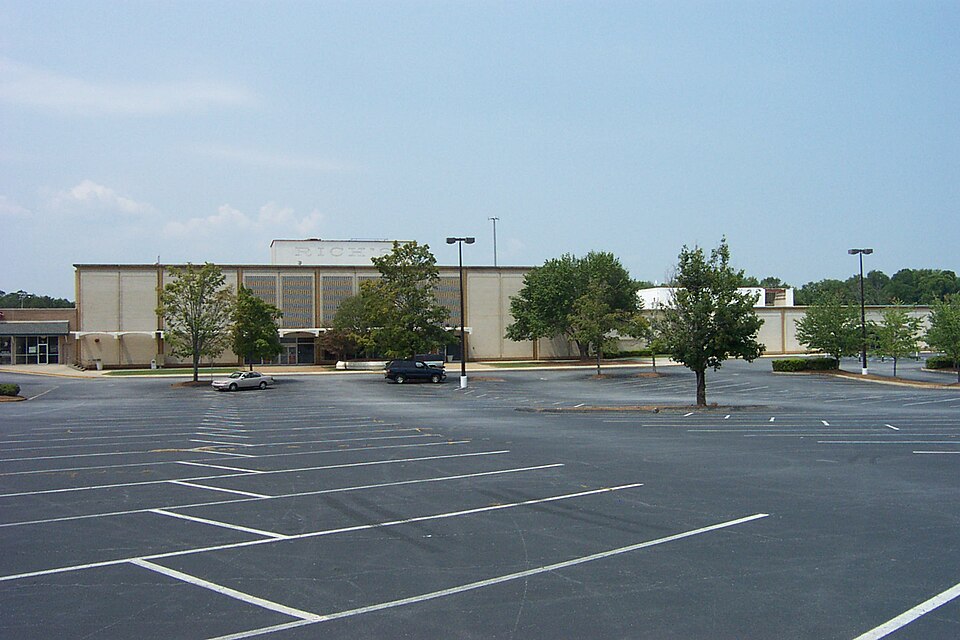 Cobb Ctr MallSmyrna, GA · 2004Partial Regreened · Partial regreening, parkColumbus Square MallColumbus, GA · 2005Redeveloped · Redevelopment: civic
 Furniture StoreNorcross, GAReinhabited · Reinhabitation: ethnic mallHouston MallWarner Robins, GA · 2014Reinhabited · Reinhabitation: healthcare
 Phipps PlazaAtlanta, GA · 2018Partial Redeveloped · Partial redevelopment, mixed use